
雪崩情報
更新日時: 2021/12/07 07:00
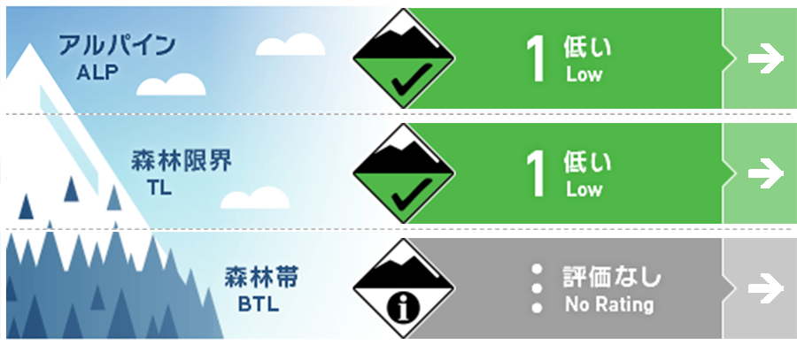
ニセコ・羊蹄・余市・尻別
アルパイン Fair アルパインでは局所にウインドスラブ。Pockets of windslab can be found in the alpine.
森林限界 Good 日射面で濡れた雪による点発生雪崩の可能性。Loose wet slides may occur on steep canyon walls exposed to solar radiation.
森林帯 Good 標高が低いところでは十分な積雪がまだありません。There is not enough snow at low elevations for slab avalanches to occur.
信頼度:○ good □ Fair △ Low
行動と地形の助言
温かい天気が続き、積雪は減少しています。このため、バックカントリーでの行動は困難になっています。濃いブッシュや笹など、シーズン初めに注意すべき危険要素が、冬季のいつもの移動ルートを妨げています。植生の影響もあり、地形がより開けているところでは注意が必要です。The warm weather weather is causing the snowpack to continue shrinking. This is making backcountry travel increasingly difficult with thick bushes, sassa and other early season hazards obstructing most winter travel routes. Be wary that the vegetation may push you to travel in avalanche paths where the terrain is more open.
留意すべき雪崩
点発生湿雪雪崩 Wet Loose snow


濡れた雪による雪崩が気温がとても髙い時間帯で発生の可能性が上がります。Loose wet slides will be most likely in the warmest parts of the day as the snowpack loses its cohesion.
ウインドスラブ Wind slab


概要
雪崩
過去48時間で新しい雪崩は観察されていません。No avalanche observations have been reported in the past 48 hours.
積雪
10~20cmの新雪が、しっかりと再凍結されたベースの上に載っています。全体の積雪深は標高に応じて30〜80cm程度です。樹林帯ではいくつかのウィンドスラブが観測されていますが、旧雪面とよく結合しており、今後数日間予想される安定した天気はそれの状態を継続させると思われます。10-20cms of new snow sits on a well consolidated, re-frozen base. The total snowpack depth varies from 30-80cms depending on elevation. Some wind slab has been observed at treeline however it is bonding well to the old snow surface and these bonds will continue to improve with the stable weather expected over the next few days.
天候
移動性の高気圧の接近により、金曜まではおおむね晴れ、気温も低くなる予報が出ています。この期間は弱い北風が吹き、降水量は少なくなることのことです。A high pressure system is moving into the region bringing mostly clear skies and mild temperatures through until Friday. Throughout this period, the region will see a light Northerly flow with minimal precipitation.


