
雪崩情報
更新日時: 2022/03/05 07:00
ニセコ・羊蹄・余市・尻別
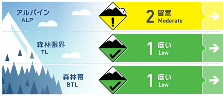
アルパイン Good 孤立して形成したウインドスラブが稜線の風下側にあります。Isolated pockets of wind slab can be found in exposed areas below ridgeline.
森林限界 Good 小さいスラブが北西に面した急斜面に形成している可能性があります。Low volume slab may be found lee to the North West in steep terrain.
森林帯 Good 標高の低い場所は、春のコンディションです。グライドクラックが懸念事項です。Spring conditions can be found at lower elevations with glide cracks remaining a concern.
信頼度:○ good □ Fair △ Low
行動と地形の助言
日中の昇温は大きく、標高の低いところの積雪は濡れて、重く、ストップスノーにもなっています。グライドクラックは拡大していますので、気温が大幅に上がる日には崩落の危険が高まります。週末、風が強まった際は、樹木からの落雪にも注意してください。雪はとても重いのでぶつかると大きな事故となります。As we are now experiencing warm conditions during the day the snowpack at lower elevations is becoming heavy and sticky, glide cracks have continued to grow and are a concern to fully release on any warm day. With increased winds over the weekend watch for chunks of frozen snow that have fallen from trees and can cause accident if you come into contact with them.
留意すべき雪崩
ウインドスラブ Wind slab


地形内に孤立して形成しているウインドスラブが、風下斜面に形成している可能性があります。このスラブは人の刺激に対しては鈍く、誘発しづらいでしょう。この週末は荒れた鉄器となり、15 cm以上の降雪があった場合、南側の斜面には警戒すべきスラブが形成されると考える必要があります。Isolated pockets of winds slab may be found in exposed terrain at higher elevations below ridgeline lee to the North West winds. Currently, it is expected that this slab will be hard to trigger. Gale-force winds are forecasted over the weekend and new slab may build across Southerly slopes if we also receive new snow accumulation greater than 15cm.
概要
雪崩
過去数日間、新しい雪崩は観察報告されていません。No new avalanche activity has been reported over the last few days.
積雪
過去数日の暖かい気温が積雪表層の変化を促し、強度を高めました。それまでにあった荒天の雪は、積雪中層にて厚み40-60 cm程度のよく焼結した層を形成しています。標高が低い場所では、春の融解凍結サイクルとなっています。Warmer temperatures throughout the last several days have helped to consolidate the snowpack and allow it to gain strength. The latest new snow and wind events appear to have now settled with 40 to 60 cm of well-bonded snow overlying no reactive instabilities in the mid-pack. At lower elevations, we are now starting to see spring melt-freeze conditions beginning.
天候
週末に低気圧が通過し、冬型の気圧配置による強い北西風が予報されています。また、継続期間は短いものの、まとまった降雪も予報されています。A low-pressure system will pass over the region during the weekend bringing increased wind speed rising to gale conditions from the North West. We can also expect periods of snowfall that will be short-lived.


