
雪崩情報
更新日時: 2021/12/21 07:00
ニセコ・羊蹄・余市・尻別
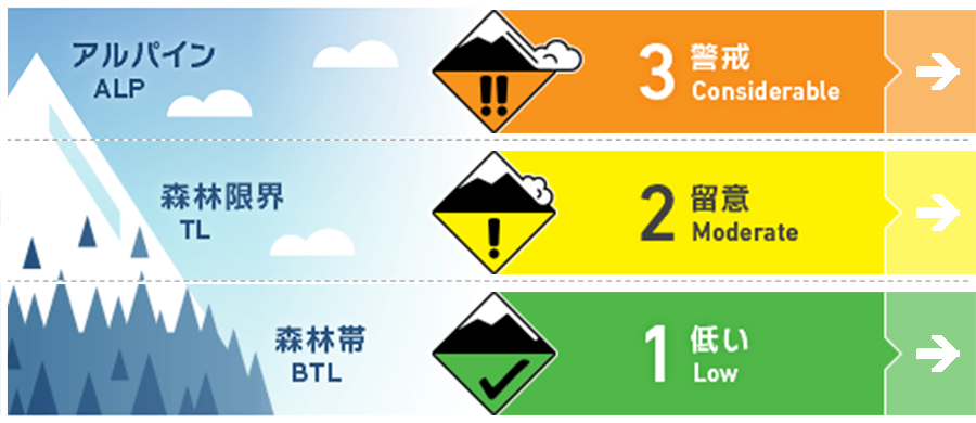
アルパイン Low アルパインエリアの観察情報は限定的ながら、風下側にはウインドスラブの形成が強く疑われる状況。Alpine observations are limited however it is expected that Wind slab has formed on leeward features.
森林限界 Good ストームスラブと旧雪の結合を上げるまで、大きく急な斜面は避けるように。Avoid large, steep slopes until the storm slab has bonded to the lower pack.
森林帯 Good 荒天の雪は焼結を進めつつ、旧雪とよく結合しています。積雪のアンカーとなるブッシュなどが、まだ雪面は雪面直下に多数残っています。Storm snow is consolidating and bonding well to the old snow surface. Lots of anchors remain above and just below the snow surface.
信頼度:○ good □ Fair △ Low
行動と地形の助言
バックカントリーの積雪状態は、とても柔らかく深いシーズン初めの状況です。よって、十分に埋没していない障害物や、その周囲にできている空洞に注意が必要です。Very deep conditions exist in the backcountry so be aware of snow immersion hazards particularly with large voids around partially buried obstacles.
留意すべき雪崩
点発生乾雪雪崩 Dry Loose snow


急斜面では滑走者の刺激で点発生雪崩が起こりうる状態です。Expect loose dry avalanches to be reactive to skier triggers on steep slopes.
ウインドスラブ Wind slab


中程度から強い風がアルパインエリアでは、荒天の期間、吹き続けており、多量の雪が移動しました。稜線の下方地形で、風で移動した雪が堆積した状況を探してみてください。Lots of snow has been available for transport and moderate to strong alpine winds have persisted throughout the storm. Look for heavily loaded features just below ridge crest.
ストームスラブ Storm slab


本日は日中の昇温の影響を考えてください。また、ストームスラブ内にはウイークインターフェイスが存在しているので注意が必要です。Monitor the transition of the new snow into a slab particularly as temperatures warm during the day Tuesday. Also be aware of interfaces within the storm layers.
概要
雪崩
滑走者の誘発によるサイズ1の点発生雪崩が12月19日に観察報告されています。Skier triggered size 1 Loose dry avalanches were observed on Dec. 19
積雪
今朝までの5~15cmの降雪があり、この荒天による降雪量は70 cm程度となりました。表層から40 cmほど下に結合力の弱い面がありますが、表層は低密度のままです。その下層30 cmほどの荒天の雪は結合力を高めていて、旧雪ともよく結合しています。An additional 5-15cms of new snow arrived last night bringing the settled storm total to ~70cms. There is a notable interface within the storm snow down 40cms however the top layer remains very low density with no slab quality. The lower 30cms of storm snow is consolidating into a slab but bonding well to the old snow surface. The lower pack is well consolidated.
天候
本日は降雪も僅かで、気温も穏やかなものとなり、凍結高度も350 mまで上昇、その後、夜遅くに冷えてくる予報です。今晩から明日に掛けて、まとまった降雪の予報が出ています。Today will bring lighter snowfall and milder temperatures with the freezing level rising to 350m before dropping back down later this evening. Heavy snowfall will resume tonight and through the day tomorrow. Winds will be light from the South this morning before moderate West to NW winds take over later in the day.


