
Avalanche Bulletin
更新日時: 2022/04/01 06:00
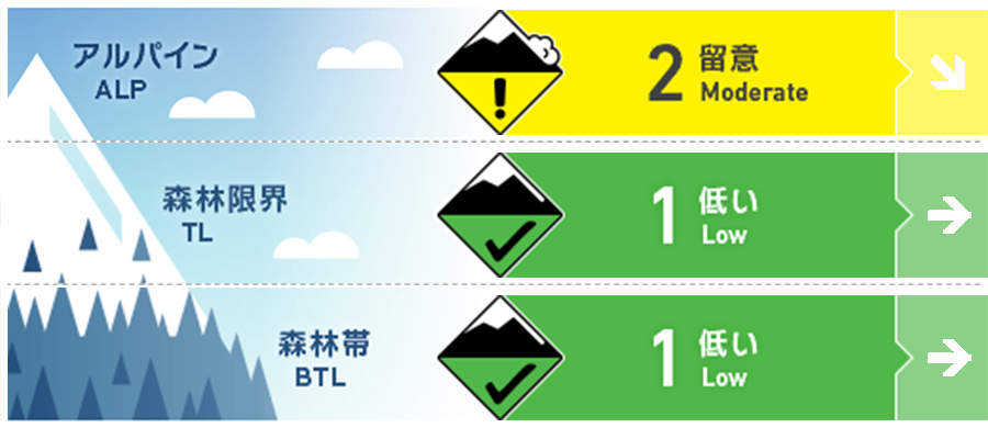
Myoko
Alpine Low 新雪の量による
Treeline Fair
Below Treeline Good
信頼度:○ good □ Fair △ Low
Travel and Terrain Advice
At high altitudes, it seems that some fresh snow is placed on the hard and frozen snow surface, so please be wary of slipping down regardless of mountain climbing or sliding. Also, if there is a place where fresh snow is blowing up due to strong northwest winds, please check the state of connection with the old snow. Even if the snow does not move enough to become an avalanche, there is a very hard snow surface underneath, so don't forget that if you scoop your feet lightly, it can be like a slide down. Even if the weather recovers, the temperature does not rise, so it is likely to be a chilly day. Have a safe day
Avalanche Problem
ストームスラブ Storm slab


新雪の量によるので確認を。
概要
Avalanche
There were no new avalanche observations reported yesterday (3/31).
Snowpack
Yesterday, there was light rain at low altitudes, and the snow cover was sufficiently wet. At high altitudes, it became sleet, and it seems that there was some snowfall at night. This snowfall is common on the west side of the mountain range, and slightly on the east side. Also, since last evening, the temperature has dropped significantly at high altitudes, and a very strong northwest wind is blowing, so the snow surface is hard and frozen.
Weather
The Japan Meteorological Agency predicts northwest wind, cloudy weather, early morning to evening, sunny, and a high temperature of 9℃ (elevation 13 m) for the Joetsu region of Niigata prefecture. The temperature is -4℃ (as of 5:00) at Myoko Sasagamine (elevation 1,310m).