
Avalanche Bulletin
更新日時: 2023/03/03 05:00
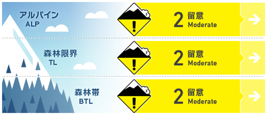
Kagura Tanigawa Hotaka
Alpine Low
Treeline Low
Below Treeline Low
信頼度:○ good □ Fair △ Low
Travel and Terrain Advice
Wind slabs are expected to form on the steep slopes just below the ridge and branch ridges due to strong winds since yesterday. Please be careful of bonding. The interior of the snowpack is expected to be weak at lower elevations due to rain at the beginning of the day. Be aware of block collapses from cliff-like areas and glide avalanches from open glide cracks. Avoid under such areas. Or move quickly.
Avalanche Problem
ウインドスラブ Wind slab


Be careful of steep slopes on the ridge and just below the branch ridge.
全層雪崩 Glide slab


Beware of cliff-like slopes and open glide cracks.
概要
Avalanche
No report due to low number of people entering the mountain yesterday.
Snowpack
Yesterday's rainfall is expected to affect at least 1400m. It has since turned to snow with strong west to northwest winds and is expected to form wind slabs on the ridge and just below the branch ridges. At lower elevations, the internal strength of the snowpack is expected to be weak due to the effects of the recent elevation and rainfall.
Weather
As of 4:00 p.m., 12 cm of snow has fallen in the past 24 hours at AMeDAS Fujiwara, with light snowfall continuing in the surrounding areas. The Japan Meteorological Agency (JMA) is forecasting that the winter pressure pattern will loosen and high pressure will cover the area, but the area will be affected by a pressure trough and moist air, resulting in clear skies at the foot of the mountains in northern Gunma Prefecture and cloudy morning and evening skies.