
Avalanche Bulletin
更新日時: 2024/02/23 05:30
Hakuba
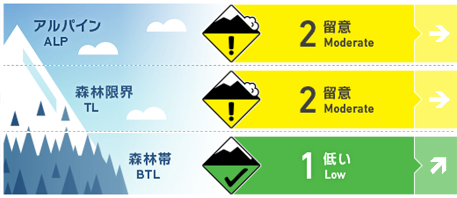
Alpine Low Note the intensity and amount of snowfall
Treeline Low Note the intensity and amount of snowfall
Below Treeline Fair Note the intensity and amount of snowfall
信頼度:○ good □ Fair △ Low
Travel and Terrain Advice
Since the snowfall has been weak at higher elevations, watch out for storm slabs formed by the snow. Also, be wary of slipping on icy snow surfaces hidden by thin fresh snow. Please consider careful route setting to avoid entering steep slopes. The heavy rains of the 21st have melted the snow in the lower elevations. Some tour routes that are usually accessible may not be available this year. Please plan carefully.
Avalanche Problem
ストームスラブ Storm slab


Snowfall since yesterday has formed storm slabs. Southwest to west winds of about 10 m/s are blowing on the main ridge.
概要
Avalanche
No new avalanches were reported yesterday (22nd).
Snowpack
The snow surface layer was sufficiently wet from the heavy rainfall on the 21st and then froze with the subsequent drop in temperature. Then, yesterday morning (22nd), glaze was formed. Subsequent snowfall has been light, leaving a mix of areas with very hard, frozen snow surfaces exposed and areas with a thin layer of fresh snow (10-15 cm) on top of the frozen surfaces.
Weather
The Japan Meteorological Agency is forecasting northerly winds, cloudy skies, snow in places, and daytime highs of 4 °C for northern Nagano Prefecture. At 703 m elevation in Hakuba, the temperature is -2.4 °C (as of 5:00 a.m.). The Nagano District Meteorological Observatory is forecasting 5 cm of snowfall for northern Nagano Prefecture in the next 24 hours until 6:00 a.m. on the 24th.
