
Avalanche Bulletin
更新日時: 2025/01/31 07:00
Niseko Yotei Yoichi Shiribeshi
Alpine Low Heavy amounts of new snow in the last 48 hours; increased loading on known weak layers without new observations, making the uncertainty very high.
Treeline Fair With avalanches being reported yesterday and more snow and wind since, considerable avalanche danger exists and could rise higher.
Below Treeline Good High rates of new snow have raised the avalanche danger below the tree line today.
信頼度:○ good □ Fair △ Low

Travel and Terrain Advice
A large step back is recommended today as the avalanche danger has risen. Travel in avalanche terrain is not advised without expert assessment skills.
Avalanche Problem
ストームスラブ Storm slab








Over 50cm new snow has fallen last 48 hours
ウインドスラブ Wind slab











Wind slab problems exist even below tree line.
点発生乾雪雪崩 Dry Loose snow


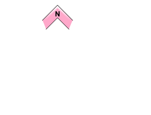







Isolated to very steep terrain over 38 degrees.
概要
Avalanche
New wind slabs reported tree line; Mt Yotei size 1 on east and northeast aspects failed on crust, surface hoar and surface facet combo, buried on 1/28. Small loose, dry sluffs on Mt Shiribetsu ran far, but no entrainment of additional snow was reported.
Snowpack
Up to 19 cm of new snow in the last 24 hours in Sapporo and Otaru. 15cm in Kutchan. Storm totals over 40cm in the last 48 hours at sea level. Kiroro has received 40 in the last 24 hours. This has fallen on poor bonding bed surfaces of buried surface hoar, surface facets, and crusts. NW Winds on top Annupuri have been steady at 5 m/sec, gusting to 15m/sec, strong enough to transport snow onto lee and crossroads aspects. The mid and lower snowpack are strong and well bonded, yet slowly sliding down on the ground.
Weather
A Northwest flow continues today with heavy snowfall in the Niseko mountains and Yoichi area. Less snow is expected in the Shiribetsu area. The winds are Strong from the NW at ridgetops in the Yoichi. The Southern area is expecting milder conditions than the Niseko areas. Freezing level at the surface.

