
Avalanche Bulletin
更新日時: 2025/03/06 06:30
Myoko
Alpine Fair
Treeline Fair
Below Treeline Fair Depends on the amount of snow or rainfall
信頼度:○ good □ Fair △ Low

Travel and Terrain Advice
Snowfall has begun in the northern part of the Myoko mountain range. The forecasted snowfall is not heavy, but watch out for storm slabs in areas with more accumulation of fresh snow due to the strong westerly winds. Yesterday, it appears that the snow surface was wet at all elevations, so check the bonding of this snow surface with the new snow. Meanwhile, at very low elevations, positive temperatures continue, as well as weak precipitation. The danger of glide avalanches continues, so stay away from slopes with glide cracks.
Avalanche Problem
ストームスラブ Storm slab


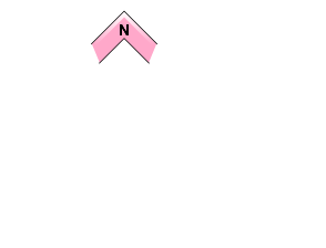





Watch for more snowfall in the future and steep slopes with high snow accumulation due to winds.
全層雪崩 Glide slab


Only in elevation zones where it is raining.
概要
Avalanche
Yesterday (5th), several size 1-2 glide avalanches were observed in the morning. Numerous snowballs were also observed during the day.
Snowpack
High temperatures and light precipitation yesterday left previously new snow wet. The inflow of cold air due to the winter pressure pattern began yesterday evening and temperatures are dropping. Weak snowfall has also begun this morning in the northern part of the Myoko mountain range. At very low elevations, positive temperatures have continued since yesterday, and we continue to need to watch for glide avalanches.
Weather
The Japan Meteorological Agency is forecasting westerly winds, rain or snow, occasionally cloudy, with a daytime high of 6 °C (13 m elevation) for the Joetsu region of Niigata Prefecture. At Sasagamine, Myoko (elevation 1,310 m), the temperature is -3 °C (as of 4:45 a.m.), with no new snowfall in the past 24 hours. The Niigata District Meteorological Office is forecasting 10-20 cm of snowfall along the mountains of the Joetsu Region on March 6 at 6:00 am for the 12-hour period ending at 6:00 pm today.

