Avalanche Bulletin
更新日時: 2021/11/30 07:32
Tateyama
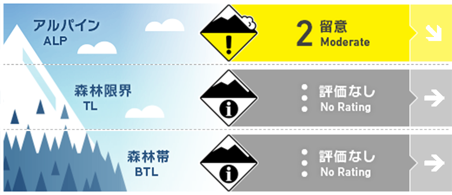
Alpine Low ストームスラブに関する情報が少ないため
Treeline
Below Treeline
信頼度:○ good □ Fair △ Low

Travel and Terrain Advice
Note the provocation of new wind slabs, which are formed on the extreme steep slopes directly below the ridge line, the supporting ridge. Also keep in mind the possibility of triggering storm slabs from places of thin snowfall, such as wind-prone support ridges. The weak layer of this storm slab is deeply buried, so it is likely that it will increase in scale when induced. It is forecast that the temperature will rise when it is sunny. Be aware of the possibility of wet snow point avalanches from large steep slopes exposed to insolation during the day. Be careful of the “traps of the terrain” such as rocks, deep ravalanches, and cliffs that can increase damage even in small avalanches.
Avalanche Problem
ストームスラブ Storm slab


ウインドスラブ Wind slab


概要
Avalanche
No new avalanches were reported yesterday (29th). Multiple surface avalanches of size 2 were reported on the 27th on a southward slope around 2400m.
Snowpack
There has been no new snowfall from 28th until this morning. Due to the effects of yesterday's solar radiation, crusts are projected to form on the surface of the snow cover on the steep slopes toward the south. Snowfall due to stormy weather from 22nd to 27th is over 200 cm above the old snow and sintering is progressing. On the border with the old snow, crusts formed due to rainfall at the beginning of this stormy weather, and recrystallization was observed at the top of it. The coupling of this layer is expected to get better gradually, but caution is needed because there is little information.
Weather
The Japan Meteorological Agency has issued a forecast that it will be sunny and cloudy at the foot of the mountain and rain late at night because it is expected to move to the northeast while a low pressure with a front line in the Sea of Japan is expected to develop.

