
Avalanche Bulletin
更新日時: 2022/01/04 07:00
Niseko Yotei Yoichi Shiribeshi
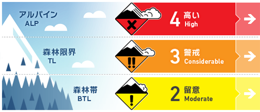
Alpine Fair 北風による大量の降雪なっています。ウインドスラブの形成が強く疑われ、滑走者の加重で反応する可能性があります。最新の情報が集まるまで、アルパインエリアは避けてください。Large volumes of new snow have been available to be transported by the gale Northerly winds. We expect winds slab to be found on lee slopes and may be reactive to single-person loads. Avoid the Alpine at present until more information is gathered on the is latest wind event.
Treeline Fair 標高が低い場所でも、北風の影響があるところにはウインドスラブが形成しています。このスラブは、既に積雪内にある脆弱性に刺激を与えており、もし発生した場合、より大きなもとなる可能性があります。斜度の緩い場所から一日を始め、状況を確認しながら行動してください。Wind slabs will have formed at lower elevations on slopes lee the Northerly winds. These slabs may overlie reactive weakness buried deeper in the pack that may produce a higher degree of consequence. Choose lower angle terrain to start your day and evaluate conditions carefully before venturing onto steeper terrain.
Below Treeline Low ストームスラブが過去数日間、反応を見せています。ここに大量の降雪が載っていますので、さらに積雪にはストレスが掛かっていると考えてください。Storm slabs were reactive over the previous few days these may now be further stressed by a higher volume of new load.
信頼度:○ good □ Fair △ Low
Travel and Terrain Advice
In such severe and stormy weather, direct observation in the field is almost impossible, so it is necessary to act more cautiously in the coming days. At high altitudes, even if the northerly winds subside, the snow cover is likely to be hard. On the other hand, at low elevations, do not approach slopes where the wind moves snow and suspects the formation of wind slabs. After such a large wind event little in the way of field observations have been gathered, A cautious approach should be adopted over the coming days. Expect the Northerly aspects to be wind stripped with the possibility of firm conditions especially in the alpine. Don't get caught out on lower elevation slopes on the lee side where much of the latest Wind-blown snow may have ended up.
Avalanche Problem
ストームスラブ Storm slab


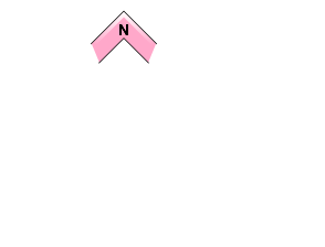

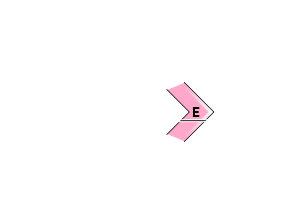
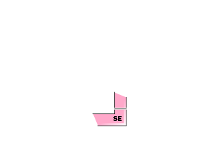
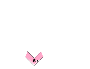
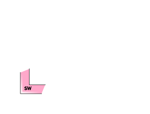












先週末からストームスラブが反応を見せています。特に風下側ではさらに降雪が載っていますので、重大な結末をもたらす雪崩が誘発されるかも知れません。Storm slabs have been reactive over the previous weekend. With additional load especially on lee slopes, these slabs may produce a higher consequence if triggered.
ウインドスラブ Wind slab


北風によって大量の雪が風下側に運ばれ、密度の高いウインドスラブが形成しています。Gale force winds from the North will have deposited large volumes of new snow onto the lee creating cohesive slabs.
概要
Avalanche
There are no observational reports of new avalanches. No new avalanches have been reported
Snowpack
It seems that there has been a new snowfall of 20 to 50 cm in the past 24 hours. The northerly wind is continuously blowing, so it is necessary to consider that this fresh snow is moving considerably to the leeward side. Before the stormy weather came, an avalanche of storm slabs about 30 cm thick occurred, and this vulnerability was buried under fresh snow. The lower layer of snow cover has increased strength. An estimated 20 -50 cm of new snow has fallen across the region over the last 24hrs. With prolonged Northerly Gale-Force winds, we expect much of this new snow to have been transported to the lee. Previous to this latest storm the upper snowpack was producing failures 30cm down below a Storm slab which may now be buried further. The lower pack continues to gain strength and consolidate.
Weather
In the past 24 hours, a fierce northerly wind has blown, and the avalanche announcing area has become a blizzard-like state. According to the weather forecast, the wind is expected to weaken due to the high pressure moving in the middle of the week. Also, snowfall is forecast to gradually weaken on Wednesday as the wind direction changes to the south. The last 24hrs have been dominated by Gale Northerly winds bringing blizzard conditions to The region. Overnight on Monday, we have seen these wind speeds decrease as a low pressure system weakens and moves to the West and large high-pressure system begins to itself known during the middle of the week. Precip will slowly begin to lessen into Wednesday in line with the wind direction coming around to the South.


