
Avalanche Bulletin
更新日時: 2022/01/05 06:30
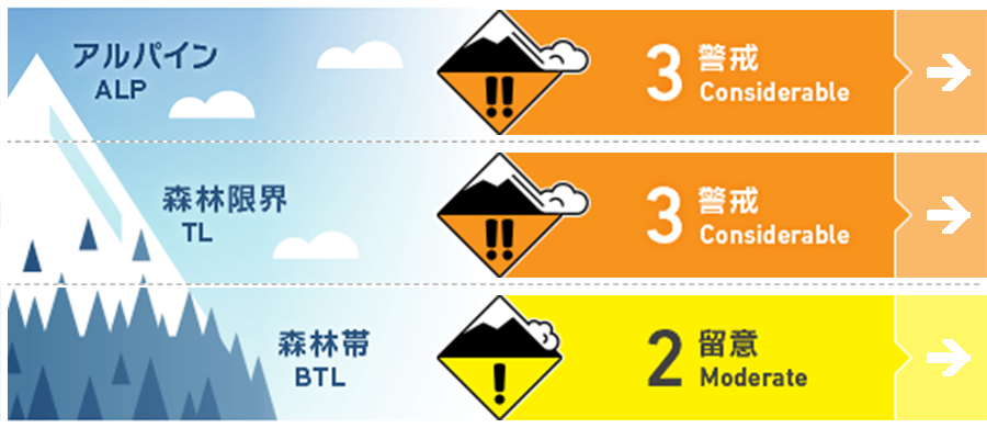
Myoko
Alpine Low
Treeline Low
Below Treeline Fair
信頼度:○ good □ Fair △ Low
Travel and Terrain Advice
There is a danger of storm slabs due to cohesive snowfall. The higher the elevation, the lower the temperature, so consider that the resolution of instability will only proceed slowly, so please do not lift your vigilance even if snowfall has subsided. When visibility is low, it is difficult to notice hazards above you. Always think about whether there is a large occurrence zone or if you are inside the avalanche runway or deposition area. The snow is deep and it is difficult to move around without skis. In such a case, even in a small terrain, if there is a trap of the terrain below the slope, it will be a serious outcome. Please ask for appropriate group management, such as acting while maintaining contact with a sense of distance that allows you to see your friends.
Avalanche Problem
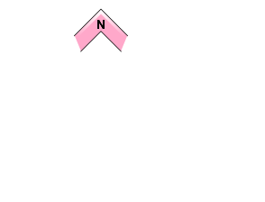
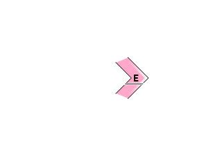
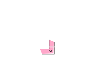
ストームスラブ Storm slab






概要
Avalanche
Due to stormy weather yesterday (5th), there are no reports of a the new avalanche.
Snowpack
It will be a cohesive snowfall, and it will be on the old snow surface. At the beginning of the fall, this snowfall began with rain or sleet at a low elevation, and it was snowing from the beginning at a high altitude. The freezing altitude is generally around 600 m. As mentioned in yesterday's avalanche information, this consolidated snowfall rests on a hard snow surface hit by previous winds. There are no reports in the Myoko Mountains, but in the adjacent Hakuba Mountains, multiple avalanches due to human stimulation have been reported at the boundary of the below treeline.
Weather
The Japan Meteorological Agency is forecasting westerly winds, slightly stronger, snowy, sometimes cloudy from the afternoon, and a maximum temperature of 2℃ (elevation 13m) for the Joetsu region of Niigata prefecture. There was a snowfall at Myoko Sasagamine (elevation 1310m) with a temperature of -10 ℃ (as of 6:00), 15 cm in the last 12 hours and 51 cm in the last 24 hours.

