
雪崩情報
更新日時: 2022/01/06 07:00
ニセコ・羊蹄・余市・尻別
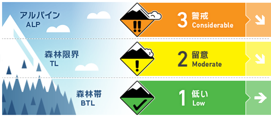
アルパイン Fair 何日も継続した強い北風と大量の降雪で、風下側にはウインドスラブが形成しました。稜線直下は特徴的な地形には、局所的なスラブが存在しています。Multiple days of gale Northerly winds combined with high volumes of new snow available to transport will have resulted in wind slab formation on lee slopes. Pockets of slab will be found in specific areas below the ridgeline and terrain features.
森林限界 Fair 直近の降雪と強風によって、風下側にスラブが形成しています。急斜面に滑りこむ前に、時間を掛けて状況を見極めてください。The latest new snow combined with strong to gale force winds will have created slab on the lee. Take the time to assess the conditions before stepping out onto steep angled terrain.
森林帯 Fair 賢い地形選択を続け、急な沢地形や川が形成した崖状地形など、重大な結末をもたらす地形の罠を避けるようにしてください。Continue to make smart terrain choices and avoid clear terrain traps such as steeply angled gullies and riverbanks where the consequence will be higher.
信頼度:○ good □ Fair △ Low
行動と地形の助言
強い風によって、この数日間、行動は標高の低いところに限らえていました。標高の高いところを目指す場合は、事前にマインドセットをする必要があります。風下となる斜面や稜線の下方にで、風によってなめらかに均された雪面がないか探してください。警戒すべき場所です。重大な結末を招きやすい特徴を持つ地形では、保守的なっ行動をお願いします。Gale winds over multiple days have kept terrain travel to lower elevations. An assessment mindset should be adopted if considering entering the alpine. Look for areas of smooth wind-pressed snow on lee slopes and below ridgelines which will indicate slab formation. Make conservative choices on higher consequence terrain.
留意すべき雪崩
ストームスラブ Storm slab


これまでの荒天の不安定性の経過観察を続けています。全体として積雪の中間部は強度を上げてきていますが、積雪の薄い場所では強度が低く、荷重が掛かると雪崩が発生する可能性があります。We continue to monitor a previous mid-storm weakness from the end of last week. Over all the mid-pack has begun the gain strength although in thinner areas of snow cover this weakness may be exposed and produce results if over loaded.
ウインドスラブ Wind slab


北寄りの強風が数日続きましたが、今後、風向きが変わることでウインドスラブの形成場所が変わる可能性があります。After multiple days of gale winds from the Northerly quarter expect wind slabs to be found on lee slopes.
概要
雪崩
新しい雪崩は観察報告されていません。No new activity has been reported. If you have observed avalanche activity in the region please contact us.
積雪
複数の荒天を経て、積雪の強度は増してきています。積雪表層付近の不安定が懸念されてはいますが、全体的には結合状態は良い方向にあります。The snowpack appears to be now gaining strength after multiple storm events. Near-surface instabilities are our greatest concern as the mid-pack is bonding well and shows little in the way of concern.
天候
強風とまとまった降雪が続いた週の前半が終わり、天候は落ち着いてきました。高気圧が北海道上空を通過するため、新雪と風は収まる予報がでています。しかし、この小康状態もすぐに終わり、今週末には再び、降雪となる予報です。After strong to gale force winds and continuous snowfall early in the week we will move to a period of more settled weather. A high-pressure system will cross Hokkaido resulting in a drop in new snow totals and wind speeds. This lull will be short-lived as we see increased snowfall at the end of the week.


