
Avalanche Bulletin
更新日時: 2022/01/15 07:00
Niseko Yotei Yoichi Shiribeshi
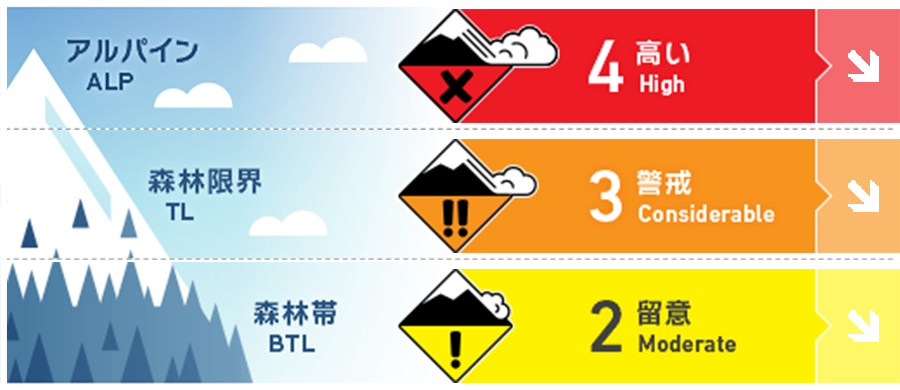
Alpine Fair 強風が最近の雪を移動させ、風下側にスラブを形成させています。High winds speed will have transported the latest new snow onto lees slopes producing slabs
Treeline Good 森林限界は、ストームスラブが特定の場所に偏在しており、地形選択が難しい状況です。真新しい雪崩の発生跡などを探してください。The treeline has the potential for difficult terrain choice decisions with wind slabs likely to be found on the lee and storm slabs in specific areas. Look for signs of recent activity.
Below Treeline Good 一般的な安全なルート設定をしてください。標高の低いところでは、斜面上方からでは視認できないグライドクラックに注意が必要です。Normal safe travel techniques are required. Be wary of glide cracks at lower elevations that may not be seen from above.
信頼度:○ good □ Fair △ Low
Travel and Terrain Advice
When the weather recovers, look for the new avalanche steep slopes, especially the eastern slopes. If the weather has lasted for many days, think carefully about the intended route and check the condition on a small, secure slope before entering a high avalanche hazard slope. A good day for action in the backcountry seems to last a few days, so use your time today to check the conditions of the snow cover. As the Storm lifts look for signs of recent activity on steep terrain especially on Easterly slopes. After multiple days of stormy conditions take the time to fully assess your desired route and choose less consequential terrain to build confidence on conditions before moving onto more exposed slopes. We should have a few good days coming up to get further into the backcountry so take the time to test the snowpack.
Avalanche Problem
ストームスラブ Storm slab


風の影響の弱いところでは、ストームスラブが存在しています。風や気温の変化によって、荒天の雪が不安定となり、大きな荷重で誘発される可能性があります。In protected areas not affected by the winds, storm slabs may be found. Instabilities within the latest storm snow due to changes in the wind direction and speeds along with temperature changes during the storm could be reactive to heavier loads.
ウインドスラブ Wind slab


北西の強風が続き、アルパインや森林限界では、風下側にウインドスラブが形成しています。積雪を支えないような地形や、急な開放斜面では、滑走者1人の刺激で雪崩を起こす可能性があります。凸状地形や、その他の誘発しやすい箇所に注意し、稜線直下の東側に存在し、一見滑らかにみえる局所的なウインドスラブなどに警戒してください。Multiple days of strong to gale winds from the North West will have created slabs on lee slopes in the alpine and tree line. In open unsupported steep terrain, these slabs could be triggered by single-person loads. Be wary of convex rolls and other stress points and look for visual clues of where the slab are loacted in the East such as smooth wind-pressed pockets below ridgelines.
概要
Avalanche
On January 13, an avalanche of size 2 appeared on the east slope due to the avalanche management of explosives by Ski Patrol. The fracture surface is about 1m. A point-generated dry snow surface avalanche stimulated the slab in the runway and expanded into a size 2 avalanche. It flows vertically, but the amount of snow that fills enough people is moving. A local ski patrol published avalanche activity up to size 2 on a SE aspect during active Control operations using explosives on the 13th Jan. Crown walls were recorded up to 1 meter deep. A loose dry avalanche in steep terrain also on the Easterly half triggered a buried slab at a lower elevation in its path. This slab produced a long narrow size 2 (enough debris to bury a person).
Snowpack
From the previous avalanche information, the snow in the field has been added 40 cm of fresh snow, which was strongly affected by the northwest wind. Observations are limited, but the combination of fresh snow and old snow seems to be getting better in the below treeline. I think this will last for a few days. On the other hand, an unstable element in the snow in stormy weather has also been identified, which needs time until it stabilizes a little more. Since our last forecast, we have continued to be heavily affected by the NW winds combined with 40 cm on new snow accumulation. Observations have been limited but in the treeline, it appears the latest new snow has begun to bond well with the previous snow surface. We expect this to continue in the coming days however mid-storm instabilities have been observed in the latest snow and slabs will have formed that need further investigation and time to settle.
Weather
This stormy weather will end on Saturday, and there are forecasts that the northwest winds will weaken and snowfall will decrease. Clouds cut during the day, temperatures rise, and southerly winds come in on Sunday. The latest storm period will break on Saturday as the constant NW winds begin to ease and new snow totals lessen over the weekend. We expect broken clouds during the days and warmer temperatures as the winds move back round to the South on Sunday.


