
Avalanche Bulletin
更新日時: 2022/01/27 07:00
Niseko Yotei Yoichi Shiribeshi
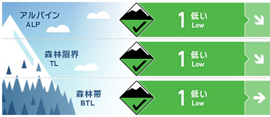
Alpine Good 現在、積雪は安定していますが、日当たりの良い斜面で積雪が増える場合、その境界面の結合状態を確認する必要があります。Stable conditions at present but testing will need to occur on the new snow, old surface interface if accumulation grows especially on Southerly sunny aspects.
Treeline Good 現在は安定した状態にありますので、降雪があった場合、その境界面の状態を確認する必要があります。Stable conditions at present, monitor the new snow totals and how this new snow bonds.
Below Treeline Good 斜面上部からでは視認できないグライドクラックに注意を。クラックは拡大中です。Watch out for growing glide cracks that can not be seen from above.
信頼度:○ good □ Fair △ Low
Travel and Terrain Advice
Keep in mind that the situation will change with the new snowfall. It's time to start re-evaluating the instability of snow cover. Glide cracks have expanded over the past few days, so act with consideration that in low elevation locations it may be completely different from last week. With new snow coming take the time to note how conditions are now before things change and We need to re-evaluate. Glide cracks have grown over the last few days and low elevation slopes you traveled last week may be completely different now.
Avalanche Problem
点発生乾雪雪崩 Dry Loose snow


今後、降雪量が30 cmを超えるまではさほど心配ありません。天気予報の通りに、風が弱い状態で大量の降雪となった場合は、これまでに南寄りの斜面に形成した硬い雪面との境界を注視する必要があります。硬い旧雪面は、良い滑り面になるからです。Little concern until new snow totals exceeds 30cm over the coming days. If winds remain low as forecast and we receive higher volumes of new snow your focus should be on the Southerly slopes that have formed a firm temperature crust over the last week which would provide a perfect bed surface to slide on.
概要
Avalanche
No new avalanches have been reported. No new activity has been reported
Snowpack
At present, the snow cover is stable, and on the steep slope facing the south, there are also effects such as rising temperatures, forming melting and freezing crusts. For the next few days, the most notable thing is the degree of coupling between fresh and old snow. The snowpack is stable at present, the Southerly aspects have been heat affected over the last week forming a temperature crust The focus in the coming days will be how any new snow and the old snow interface reacts under any new load.
Weather
The good weather that has lasted for the past few weeks also seems to end. A deep barometric valley to the west is approaching from the north, and snowfall is forecast to begin Thursday and last for several days. The westerly winds are in a weak state. It is looking like the last few weeks of dry weather will break. A deep low to the west is beginning to wrap around North and we will see bands of snowfall starting on Thursday and continuing for a few days. Winds will remain low for the West.


