
Avalanche Bulletin
更新日時: 2022/02/27 05:30
Hakuba
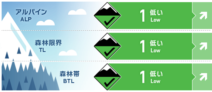
Alpine Fair 降雪強度で危険度は上昇
Treeline Good 降雪強度で危険度は上昇
Below Treeline Good 降雪あるいは降雨の強度で危険度は上昇
信頼度:○ good □ Fair △ Low
Travel and Terrain Advice
At the moment, the risk of avalanches is low, but the risk level will increase in the later snowfall situation. It is forecast that snowfall will intensify when the front passes during the day. Pay attention to its snowfall intensity and condition with the old snow surface. Even a very small avalanche will scoop up your feet. If a terrain trap is added to it (for example, a cliff below or a glide crack), it will have a serious ending. The possibility of rain is suggested at very low elevations. In that case, do not approach slopes with glide cracks.
Avalanche Problem
ウインドスラブ Wind slab


概要
Avalanche
Yesterday (26th), point occurrence wet snow avalanches and snowballs of size 1 were observed on a slope strongly affected by solar radiation and elevated temperatures.
Snowpack
At high elevations, there are windslabs that have passed time, and attention should be paid to the instability that remains in the area. Due to yesterday's warming and solar radiation, snow melting progressed at very low elevations.
Weather
The Japan Meteorological Agency predicts southern wind, rear, north wind, cloudy, occasional, sunny, early morning, temporary, snow or rain, and a maximum temperature of 7℃ (elevation 418m) for the northern part of Nagano prefecture. At the foot of Mt. Hakuba (elevation 703m), there was a temperature of -3.6℃ (as of 5:00), and snowfall of 2 cm in the past 12 hours.
