
Avalanche Bulletin
更新日時: 2022/03/01 07:00
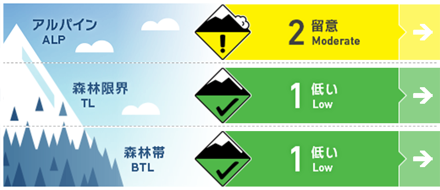
Niseko Yotei Yoichi Shiribeshi
Alpine Good 稜線付近の地形ポケットにウインドスラブが残っています。Isolated pockets of wind slab remain around ridgeline.
Treeline Good 孤立した地形に、ごく小規模のウインドスラブがあるかも知れません。Low volume pockets of surface wind slab can be found in isolated terrian.
Below Treeline Good この数日でグライドクラックが成長しています。重大な怪我の原因になりえます。Glide cracks have grown over the last few days creating a significant hazard for injury.
信頼度:○ good □ Fair △ Low
Travel and Terrain Advice
In the past few days, people entering the backcountry are looking for the slopes of Notrak, as there has been no consolidated new snowfall. When you stop, choose a safe position, and be careful to see if there are other people above or below you. Glide cracks are growing and can be called a big “terrain trap”. With not much in the way of new snow over the last few days, plenty of people will be Looking to the backcountry for some fresher turns. Be mindful of who may be above you when choosing safe places to stop. Glide cracks have grown large over the last few days and are a big terrain trap.
Avalanche Problem
ウインドスラブ Wind slab


先週末から標高の高いところでは強風が吹き、飛雪も観察されています。これにより、北西の風によるウインドスラブが風下側に形成されました。ただし、このスラブは特定の斜面の地形ポケットにあると考えられているため、皆さんが行動しながら、風で移動した雪の兆候や形成間もない雪庇の形成などを頼りに、その危険な場所を見つけてください。At upper elevations, we have had strong to gale force winds over the weekend and the early part of this week. Wind transported snow was observed at ridgeline creating pockets of slab lee to the NW winds. These slabs are expected to be in specific terrain so look signs of fresh wind pressed snow and fresh cornice development as an indication of where they have formed.
概要
Avalanche
On the western slope of Mt. Shiribetsu, we have received reports that Glide avalanche are occurring from glide cracks that have already been made. The occurrence of this avalanche is thought to have occurred during the warming period on February 26. A large glide crack release was reported on Mt Shiribetsu on a Westley aspect. It is expected that this release occurred during the warming period on the 26th Feb.
Snowpack
For several days, the freezing altitude has risen to around 700 m, and by this morning it has fallen again. There are still wind slabs in the terrain pockets near the ridges. Yesterday (2/28), we conducted a survey on the northwestern slope at an altitude of 800 m. The surface frost was buried at a position 80 cm from the snow surface, and the test results have been obtained. The spatial diversity of this noteworthy layer needs further investigation. After multiple days of the freezing level climbing up to 700m meters and now dropping Again we expect to be greeted by a firm snow surface early on Tuesday. Above this pockets of wind slab remains around ridgeline. Testing on the 28th of Feb at 800m on a NW aspect resulted in moderate compression test Failures on a buried layer of surface hoar down 80cm. Further investigation of the spatial variability of this layer is required.
Weather
The wind direction changes from south to west, and snowfall is forecast. The freezing altitude may rise temporarily, and there will be sunny days on Wednesdays. Winds are forecast to be weak to moderate. We will receive snow flurries over the next few days as the wind direction jumps from the South to the West. Freezing levels may rise again and we could see periods of sunshine on Wednesday. Winds are expected to remain low to moderate.


