
Avalanche Bulletin
更新日時: 2022/03/05 06:55
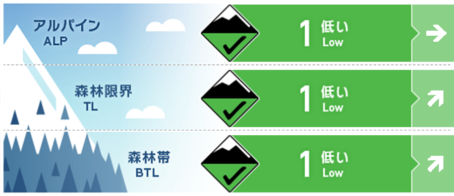
Kagura Tanigawa Hotaka
Alpine Low
Treeline Fair
Below Treeline Good
信頼度:○ good □ Fair △ Low
Travel and Terrain Advice
Note the joining of new windslabs on the ridge at high elevations, on the extreme steep slopes just below the support ridge. It is a forecast that it will clear up and the temperature will rise. Be aware of the possibility of wet and snow-generated avalanches from large south-facing steep slopes in the lower elevation zone susceptible to solar radiation and elevated temperatures, or Glide avalanche from open cracks or cliff-like slopes. It is recommended not to go into the lower part of such places or act quickly.
Avalanche Problem
ウインドスラブ Wind slab


概要
Avalanche
There were no reports of new avalanches yesterday, but there were few people entering the mountain
Snowpack
The snowfall until yesterday morning was about 30 cm. The combination with the old snow is good. On the southerly slopes, crusts are formed on the snowy surface due to the influence of yesterday's solar radiation. At a high altitude, due to the influence of the wind, the snow cover moves and the wind slab is formed.
Weather
The temperature at AMeDAS Fujiwara as of 6:00 a.m. -3.5℃. According to the announcement by the Japan Meteorological Agency at 5:00 on the 5th, it will be gently covered by high pressure, but because the cold front extending from the low pressure in the Sea of Japan will pass and it will gradually be affected by the cold, it will be cloudy and sunny in the northern part of Gunma prefecture, and it will snow from the evening. There are places where there are forecasts.