
Avalanche Bulletin
更新日時: 2022/03/19 07:00
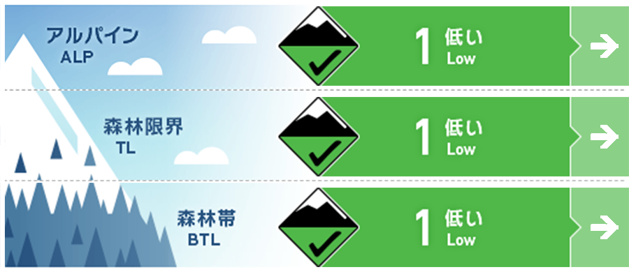
Niseko Yotei Yoichi Shiribeshi
Alpine Good
Treeline Good
Below Treeline Good
信頼度:○ good □ Fair △ Low
Travel and Terrain Advice
General spring conditions continue in areas where avalanche information has been announced. Some snowfall has slightly improved the snow surface conditions, but little has changed as avalanche conditions. If the snowfall this weekend seems to exceed 15 cm, pay attention to the state of coupling with the old snow. We continue to see regular spring-like conditions across the region at present. Brief snow showers have improved the snow surface however conditions mostly remain variable. If snow showers over the weekend produce volumes greater than 15cm be wary of the bond to The old snow surface.
Avalanche Problem
点発生湿雪雪崩 Wet Loose snow


春に向かって凍結高度が上がっていますが、この後、北風が吹く予報が出ていますので、雪面は冷やされたままとなります。日射が出た場合、その影響を強く受ける南斜面で、雪面の強度が低下している兆候を探してください。濡れた雪の点発生雪崩は、小さくとも密度が高く、とても重いので重大な結末を招く可能性があります。It is expected that northerly winds over the coming days will keep the snow surface cooled although freezing levels are rising as we continue into spring. Look for signs that the surface is heating over the coming days especially on southerly aspects if we receive periods of sunshine. Wet loose avalanches if released are heavy and dense and can have high consequences.
概要
Avalanche
No new avalanches have been observed and reported. no new activity has been reported
Snowpack
Some snowfall from the past few days is resting on the hard snow surface affected by solar radiation. However, this amount of snowfall is not enough to be unstable. There is no change in snow cover from the middle to the lower layer, and it is the same as the general spring snow cover at lower elevations. Snow showers over the last few days have seen new snow fall onto a firm surface that has been heat and sun affected. This latest snowfall has not been accumulated enough to create instability at present. The mid to lower pack remain unchanged and is resembling a normal spring snowpack at lower elevations.
Weather
Snowfall is forecast for the weekend as the low pressure moves eastward. It is said that the northerly wind will increase the wind speed on Sunday, and it will be close to strong winds near the ridge line. We are expecting the possibility of snow showers over the weekend as we feel the effect of A low-pressure system moving to the northeast. On Sunday Northerly Winds should increase speeds in possibly as high as gale in the Morning at Higher Elevations around Ridgelines.


