Avalanche Bulletin
更新日時: 2022/03/29 05:30
Hakuba
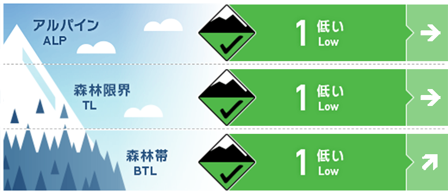
Alpine Good
Treeline Good
Below Treeline Good 日中の昇温と日射の影響に留意
信頼度:○ good □ Fair △ Low

Travel and Terrain Advice
Unlike last morning's storm, it's going to be a spring-like day. Be careful of slipping on hard and frozen slopes in the morning. If the hard snow surface starts to loosen, you will be able to glide comfortably, and at the same time, be careful of point-generated avalanches caused by wet snow. If you find a snowball on a very steep slope, which is highly affected by solar radiation, it is a sign that the snow on the surface layer has begun to lose strength. The snow cover on the slope with glide cracks has calmed down compared to just after the rainfall the other day, but predicting its occurrence is a very difficult problem. Do not get into the slopes with cracks, do not stagnate under them. Keep proper group management while using safe terrain. Have a nice day
Avalanche Problem
全層雪崩 Glide slab


概要
Avalanche
No new avalanches were reported yesterday (28th).
Snowpack
The snow cover surface layer, which was sufficiently wet by the 27th, remained hard and frozen yesterday due to the influence of strong winds at elevations higher than the upper part of the below treeline. Currently, the wind has subsided, and the temperature is only slightly minus even near the main ridge line, so it is necessary to consider changes due to the effects of solar radiation and temperature rise during the day.
Weather
The Japan Meteorological Agency predicts southerly winds, cloudy weather, sometimes sunny, and a high temperature of 15℃ (elevation 418m) for the northern part of Nagano prefecture. At the foot of Mt. Hakuba (elevation 703m), the temperature is -0.8℃ (as of 5:00).


