
Avalanche Bulletin
更新日時: 2022/12/13 07:00
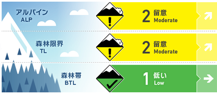
Niseko Yotei Yoichi Shiribeshi
Alpine Good Monitor bond of new snow to old surfaces.
Treeline Good Monitor bond of new snow to old surfaces.
Below Treeline Good Snow depth remains below threshold in most BTL areas.
信頼度:○ good □ Fair △ Low
Travel and Terrain Advice
Beware of complex loading patterns as today`s South winds load North slopes before the West winds begin loading East and South facing slopes. The snowpack remains shallow with lots of early season hazards present particularly at lower elevations.
Avalanche Problem
ウインドスラブ Wind slab


Watch for reverse loading during today`s southerly flow before the West winds return on Wednesday.
ストームスラブ Storm slab


Monitor the bond of today`s heavy snow to the existing snow pack and look for storm instabilities as cooler temps return and precipitation continues Tuesday night.
概要
Avalanche
Size 1 natural windslab avalanche reported on steep slope at 1600m Yotei SW aspect.
Snowpack
Existing season snowpack is 80-120cm at treeline and above. There are no notable layers within the snowpack with density steadily increasing from the surface to the bottom of the pack. Solar aspects experienced a melt freeze event during the clear weather of Monday Dec. 12. Todays warm/rain event will cause significant settlement of the snowpack particularly at lower elevations.
Weather
After almost 2 weeks of cold temps and steady snowfall, a Southerly flow takes over today bringing warm air and precipitation to the region. Freezing levels are forecasted to rise to 800m before prevailing Westerly flow returns with strong wind, cold temps and more snow for the rest of the week.


