
Avalanche Bulletin
更新日時: 2022/12/20 07:00
Niseko Yotei Yoichi Shiribeshi
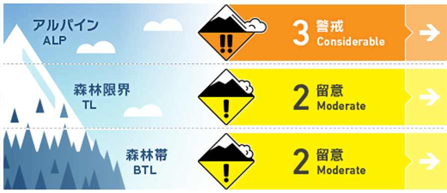
Alpine Low Pockets of brittle wind slabs can form quickly on lee and cross-loaded features.
Treeline Good Cold temperatures and lighter winds have reduced the slab avalanche likelihood
Below Treeline Good Sheltered areas the snow is loose and deep.
信頼度:○ good □ Fair △ Low
Travel and Terrain Advice
If venturing into the alpine use careful terrain evaluation. Look out for stiff new formed wind slabs and cracking on cross loaded and lee slopes steeper than 35 degrees as this would be a sign to back off and return to less wind effected snow. Watch out for getting on or below overhanging cornices. Tree-line and below tree-line there is heightened avalanche conditions on specific terrain features. Evaluate snow and terrain carefully; identify features of concern. Identify and avoid being caught in a terrain trap. On very steep terrain, Loose dry avalanches could sweep you into trees, a creek or deep gully.
Avalanche Problem
ウインドスラブ Wind slab



Wind has and will continue to transport loose dry snow forming wind slabs on lee and cross loaded features near ridge lines.
点発生乾雪雪崩 Dry Loose snow


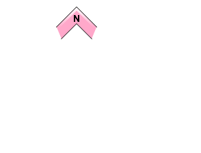

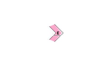
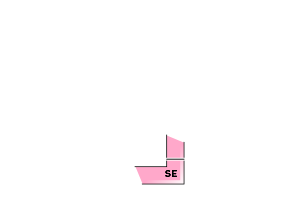



Very steep slopes greater than 40 degrees a person could trigger a loose dry avalanche which could carry someone into a terrain trap.
概要
Avalanche
No human triggered or natural avalanches have been reported. Observations in the alpine have been limited.
Snowpack
The height of the snow pack has significantly increases since last Saturday. The lower snow pack compresses and gains more strength. More snow has been depositing on the eastern facing on the lee slopes in the alpine. The Strong WSW winds have diminished to moderate since Sunday. Cold loose, light snow has deposited on the older wind effected snow. No reports of weak layers buried in the snowpack. 12/13 rain crust down 70-100cm down at the 500m elevation
Weather
Moderate west winds, moderate snow showers, and cold temperatures overnight will continue today. Winds turn southernly and light on Wednesday with a break in precipitation along with rising air temperatures. Thursdays South winds increase and temperatures rise to above freezing with heavy rain expected.

