
Avalanche Bulletin
更新日時: 2022/12/27 07:00
Niseko Yotei Yoichi Shiribeshi
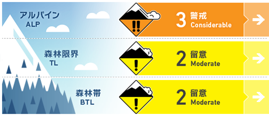
Alpine Good Slab has formed on southerly aspects from the recent snow and wind events.
Treeline Good Check for signs of instability within the latest new snow and look for pockets of wind-pressed snow in the tree line.
Below Treeline Good Avoid obvious terrain traps such as the creeks or hollows where a relatively small volume of snow can bury a person deeply.
信頼度:○ good □ Fair △ Low
Travel and Terrain Advice
Look for signs of wind-pressed snow around the ridgeline at high elevations. At lower elevations the growing snowpack is helping to bury hazards but be cautions about what may be freshly buried just below the surface.
Avalanche Problem
ウインドスラブ Wind slab
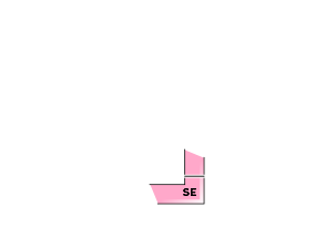



After multiple days of snowfall and moderate to gale northerly winds wind slab has formed on southerly slopes. These slabs are mostly likely to be found at higher elevations and may be triggered by light loads. Look for signs of fresh wind deposit around ridgelines.
ストームスラブ Storm slab






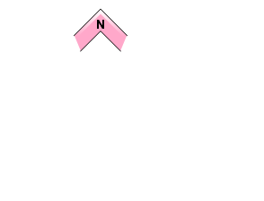




Check for any instability within the latest new snow. Density changes within the near-surface snowpack created by varying wind speeds and temperatures during the storm cycle may still result in weakness in the upper pack.
概要
Avalanche
No new avalanche activity has been reported since the weekend when a slab was released on the south face of Mt Shiribetsu alongside another slab released on the southwest face of Nitto puri with a 40cm crown that was 10 meters wide and ran for 50 meters.
Snowpack
At lower elevations, the pack has become heavy and wet due to warmer temperatures over the last few days. Some roller balling has been observed below the treeline. Higher up the conditions are drier with the latest wind event transporting new load onto the southerly half.
Weather
A relative break in the snowfall over the last 24 hours and warmer temps have been brought on by a retreating lower pressure system moving east. Temperatures have started to drop again and we expect this to continue during the week with light to moderate northerly windwhichvh will move round to the west and bring further snowfall on Wednesday into Thursday.


