
Avalanche Bulletin
更新日時: 2022/12/29 07:00
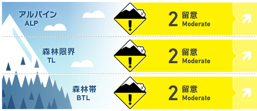
Niseko Yotei Yoichi Shiribeshi
Alpine Fair Wind has re-distributed the overnight snow to Eastern slopes.
Treeline Good Wind has re-distributed new snow to East slopes
Below Treeline Good New snow overlies hard surfaces in the BTL zone
信頼度:○ good □ Fair △ Low
Travel and Terrain Advice
Beware of areas where more snow has accumulated or where the wind has deposited deeper pockets of windslab. The new snow will need time to bond to the hard surfaces below.
Avalanche Problem
ウインドスラブ Wind slab


Northwest winds have re-distributed the overnight snow forming wind slab on Eastern slopes
点発生乾雪雪崩 Dry Loose snow


Overnight snow is light and dry and overlies hard surfaces so will be easy to trigger on steep slopes.
概要
Avalanche
No avalanches have been reported in the past 24 hours however glide cracks have been reported to open up on N/NE aspects of Yotei around 6-800m elevation
Snowpack
After several days of warms temps and no new snow, the region has received 10-20cms of light dry snow overnight. This overlies a melt freeze crust that exists on all aspects up to 800m and into the alpine on solar aspects. The lower snow pack is 80-120cms deep and the recent warm temps have helped settle and consolidate the base. Some instabilities remain in the lower snowpack but these are stubborn.
Weather
The NW flow has resumed bringing cool temps and new snow to the region. An additional 10-15cms of snow is expected through the day on Thursday accompanied by moderate to strong WNW winds. Winds will ease off overnight tonight with lighter snowfall continuing through until the end of the day on Friday. Temps will be below zero throughout this time.


