
Avalanche Bulletin
更新日時: 2023/01/14 07:00
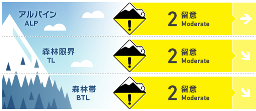
Niseko Yotei Yoichi Shiribeshi
Alpine Fair Snow has been transported onto easterly aspects as creating slab at higher elevations.
Treeline Good Temperatures will begin to lower during the day but rain at lower elevations overnight will have affected the upper snowpack.
Below Treeline Good A warm wet snow surface will begin to refreeze as temperatures lower during the day on Saturday.
信頼度:○ good □ Fair △ Low
Travel and Terrain Advice
Heavy wet snow will begin the refreeze during the day making terrain travel difficult. Be mindful of what is above you when stopping and grouping up as snow from overhead branches and trees has been releasing.
Avalanche Problem
ウインドスラブ Wind slab


Recent west to northwest winds will have created isolated pockets of wind slab around the ridgeline and in the alpine. Look for any signs of fresh loading or smooth pressed snow and test how this new load has bonded to the old snow surface.
点発生湿雪雪崩 Wet Loose snow


Until temperatures lower wet loose activity in steep terrain remains and concern at lower elevations. This instability will decrease as the freezing level lowers however be wary of steep slopes above obvious terrain traps early in the day.
概要
Avalanche
A skier-triggered avalanche incident was reported yesterday on Mt Yotei on a westerly aspect. Multiple wet loose avalanches have also been reported in steep terrain across the region over the previous 24 hours.
Snowpack
The snowpack has warmed over the last few days but will begin to lock up as temperatures lower during the day. This may create and smooth surface for new snow to fall onto in the future and this will need to be monitored.
Weather
Winds turn northerly on Saturday lowering the free air freezing level and bringing light snowfall over the coming days. Winds speeds will remain low across the region.


