
Avalanche Bulletin
更新日時: 2023/01/17 07:00
Niseko Yotei Yoichi Shiribeshi
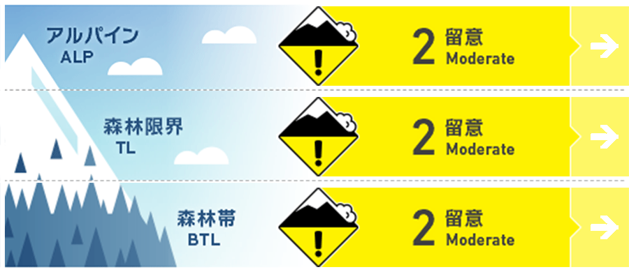
Alpine Fair Recent loose powder and soft windslab snow deposited from moderate west through north winds is sliding on the icy crust surface from the recent melt freeze cycle and forming cornices on ridge tops lee to the wind. Glide crack avalanches are present and releasing.
Treeline Good The recent loose powder snow has fallen at tree line as well and is sliding on the same icy melt/crust surface. The wind is transporting the snow creating pockets of wind slab and forming cornices on tree line ridge tops lee to the wind and glide cracks are releasing and could be present on all aspects.
Below Treeline Good The recent loose powder snow and wind has created pockets of windslab in open areas below tree line on the icy melt/freeze crust. Glide cracks are present below tree line and the new loose powder snow is sliding on steep terrain.
信頼度:○ good □ Fair △ Low
Travel and Terrain Advice
There is a strong icy crust below all the powder snow across the region. This can make for fun but challenging sliding especially on steeper terrain where it is hard to control your speed on the crust. The new powder snow is sliding on the crust and can take you by surprise and take you off balance. Beware of steep slopes above terrain traps even if they are small. The glide cracks can be difficult to see from above so take care when approaching unfamiliar terrain for first time.
Avalanche Problem
点発生乾雪雪崩 Dry Loose snow


The new light powder has fallen on top of an icy crust surface from the recent melt/freeze cycle. Beware for loose snow slides on steep terrain and run exits with steep side walls above.
ウインドスラブ Wind slab


Moderate winds from the west to the north has deposited the new snow and created pockets of wind slab at tree line ridges and in the alpine. Below tree line are pockets of wind drifted snow and wind slab.
全層雪崩 Glide slab


Reported glide crack avalanches are releasing at tree line and below tree line on different aspects.
概要
Avalanche
The last 48 hours snow has fallen in the form of light dry powder snow and has landed on an icy melt/freeze crust. Multiple loose dry avalanches have been reported in steep terrain across the region in the last 24hours. There was wind enough to transport the new snow and create soft windslab on slopes lee to the west through north. More glide avalanches are releasing and being reported.
Snowpack
The upper snowpack is mostly dry loose powder snow with some snow stiffened by the wind on slopes lee to the wind and creating slab. Below is a thick melt freeze crust that could could have poor bonded facet snow above or below the crust. This development of facets around the crust will be a concern and need to be watched.
Weather
General northwest flow for the region with steady light snow and wind becoming moderate at times. Small breaks in the clouds with periods of sun are possible. The temperatures will remain below freezing with minus single digits in the day and minus double digits at night.


