
Avalanche Bulletin
更新日時: 2023/01/24 06:00
Myoko
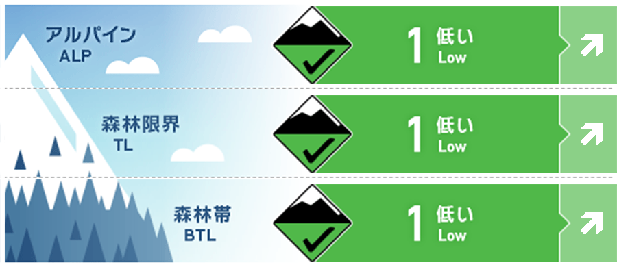
Alpine Fair Keep an eye on future snowfall
Treeline Fair Keep an eye on future snowfall
Below Treeline Good Keep an eye on future snowfall
信頼度:○ good □ Fair △ Low
Travel and Terrain Advice
This is a low avalanche danger day, but be alert for isolated and extremely shaped terrain. Heavy snowfall is forecasted associated with a very strong cold air inflow. Consider a quick escape to the foothills in the event of any incidents. Descend the mountain before the weather starts to get rough. There are numerous "terrain traps" in the forest. Imagine what is under the snow cover and choose a safe route.
Avalanche Problem
ウインドスラブ Wind slab


概要
Avalanche
Yesterday (January 23), a size 1 wind slab avalanche caused by a ski cut in isolated terrain below treeline was reported.
Snowpack
The storm snow has settled and the overall snowpack has stabilized. However, there is a high degree of uncertainty regarding the weak layer that has been observed in large numbers in the Hakuba area and in the Myoko area due to a lack of information on observations in the treeline and alpine areas.
Weather
The Japan Meteorological Agency is forecasting winds from the south, then from the north, slightly stronger, cloudy, snow before noon, and a maximum temperature of 6°C (13 m elevation) for the Joetsu region of Niigata Prefecture. At Sasagamine, Myoko (elevation 1,310 m), the temperature is -6° (as of 5:45 a.m.). The Niigata District Meteorological Observatory has issued a weather advisory on heavy snow at 6:00 on January 24. The information predicts 90 cm of snowfall along the mountains in the 24 hours from 6:00 a.m. on January 24.