
Avalanche Bulletin
更新日時: 2023/02/04 07:00
Niseko Yotei Yoichi Shiribeshi
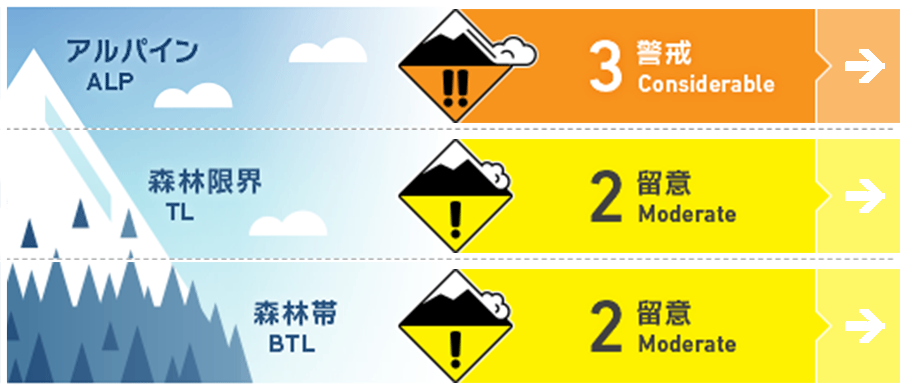
Alpine Low Limited alpine obs have reduced our confidence in the forecast at this elevation band
Treeline Good Wind slab and storm slab are present at treeline
Below Treeline Good Storm slab and loose dry avalanches are a concern in the BTL
信頼度:○ good □ Fair △ Low
Travel and Terrain Advice
Continue monitoring the storm instabilities and avoid steep slopes until the storm snow has had a chance to settle and bond. Monday is forecasted to be warmer than the previous days which may cause the storm slab to wake up and become more reactive particularly at lower elevations Manage the loose dry problem by avoiding skiing above terrain traps.
Avalanche Problem
ウインドスラブ Wind slab





Recent poor weather has prevented alpine travel limiting our knowledge of the distribution and reactivity of the wind slab problem.
ストームスラブ Storm slab












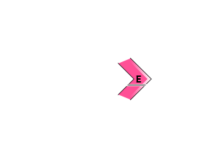
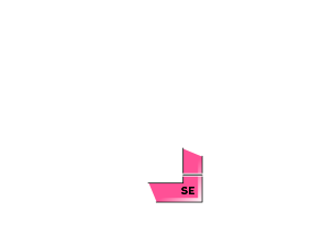






Storm slab continues to be reactive to ski cuts on steep slopes. Monitor the bond of the storm snow (~40-60cms) to the previous snow surfaces.
点発生乾雪雪崩 Dry Loose snow


Continued light, dry snow has arrived with very little wind particularly at lower elevations meaning that loose dry avalanches are very likely on steep slopes.
概要
Avalanche
No new avalanches have been reported in the last 48 hours however storm slab has been reactive to ski cuts on steep slopes.
Snowpack
Light but steady snowfall has continuously added to the storm snow total for the past several days. 40-60cms of low density storm snow overlies progressively denser snow down to the Jan. 18 MFcr which is now buried very deep, decomposing and difficult to find in many areas. A notable layer of buried stellars exists in some locations on the interface down 40-60cms however it has been unreactive to skier traffic.
Weather
A light NW flow is expected to continue through the weekend bringing continued light snow and cool temps through to the end of the weekend with heavier snowfall expected sunday night. Skies will be mostly overcast with light WNW winds through the forecast period.

