
Avalanche Bulletin
更新日時: 2023/02/14 07:00
Niseko Yotei Yoichi Shiribeshi
Alpine Fair
Treeline Fair
Below Treeline Fair
信頼度:○ good □ Fair △ Low
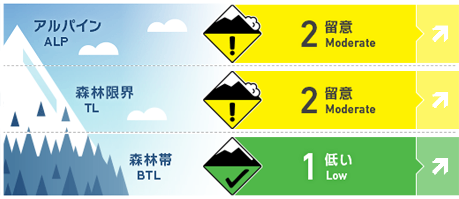
Travel and Terrain Advice
Skiing or riding one at a time will be needed and proper sluff management is required in steep terrain. Conditions may worsen during the day as we experience the start of the next storm cycle. Glide cracks continue to be a hazard, especially when obscured in low visibility.
Avalanche Problem
点発生乾雪雪崩 Dry Loose snow

















It is likely a single person can trigger a loose dry avalanche in steep terrain. This hazard will increase as further snowfall accumulates during the day and into tomorrow. Be mindful what is below you if you get knocked of your feet even in a low volume slide.
ストームスラブ Storm slab
















A certain degree of uncertainty exists as to how much new snowfall has accumulated in the north of the region over the last 24hrs. Up to 20cm of new snow is expected to have fallen with the forecast suggesting further snowfall throughout the next couple of days. With increased snow totals the hazard will grow and testing well be required as to how this new snow bonds with ther previous snow surface.
概要
Avalanche
An isolated pocket of storm slab was recorded being skier triggered on Nitonupuri on a west to southwest aspect at 800m on the 12th. Numerous low-volume point releases were also recorded. A possible size 2 (enough to bury a person) was observed from a distance on Shiribetsu on the 12th also.
Snowpack
The north of the region appears to have received a higher volume of new snow on Monday afternoon although the exact total is uncertain. The mid to lower pack appears to have settled and bonded well. Cracking has been observed around ridgeline and on isolated terrain features alongside loose dry activity in steep terrain.
Weather
A low pressure system lies off the east coast bringing relatively calm conditions on Tuesday morning. Winds will remain light for the early part of the day out of the west with snowfall expected to begin mid-morning and continue for the coming days.


