
Avalanche Bulletin
更新日時: 2023/02/16 05:30
Hakuba
Alpine Fair
Treeline Fair
Below Treeline Fair
信頼度:○ good □ Fair △ Low
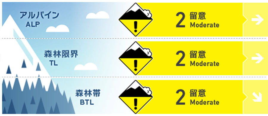
Travel and Terrain Advice
The danger of wind slabs remains on certain slopes. The new snow that fell mainly in the northern part of the Hakuba Vallery has been observed to be settling and sintering well, but strong winds have caused wind slabs to form on isolated terrain features. Be alert for slabs that have formed just below the ridge line and on the sides of the branch ridges. Also, avoid isolated terrain features where the convexity or terrain is not conducive to supporting snowpack, and look for slopes that are less affected by wind. There you will find powder snow that is dense and has good underlying support when skied. Be careful of slipping and falling on ridge tops and other areas that are exposed to strong winds, as hard Melt-Freeze crusts are exposed. Even if you feel that the snowpack is stable, please continue to take basic actions such as stopping at a safe place and skiing one at a time. This will reduce accident size. Have a good day.
Avalanche Problem
ウインドスラブ Wind slab


ストームスラブ Storm slab


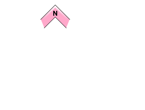

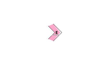
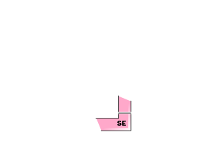



Beware of unstable snow remaining on extreme terrain shapes.
概要
Avalanche
Yesterday (February 15), some skier-triggered or natural size 1-1.5 storm slab avalanches were observed on the eastern slope of the Treeline. Shooting cracks were observed on the slopes which were affected by strong wind on the Below Treeline. Whumpfing sounds were reported on some slopes Below Treeline.
Snowpack
The 20-25 cm of new snow that fell mainly in the northern part of the Hakuba Vallery has been redistributed on the leeward side by the westerly storms. Where the very strong wind is blowing, the previous hard Melt-Freeze layer is exposed. On the leeward side, dense new snow has accumulated and, as of yesterday, had not yet fully bonded with the old snow surface, resulting in human-triggered slab avalanches. There are still areas where a temperature gradient remains between the melt-freeze crust and the new snow, named 230213 MFcr because it was buried on February 13, and will be continuous observation will continue. Whumpfing sounds were reported at this interface.
Weather
The Japan Meteorological Agency is forecasting northerly winds, sunny, occasionally cloudy, and in places snowy until morning, with a maximum temperature of 3°C (418 m elevation) for northern Nagano Prefecture. At Amedas Hakuba (elevation 703 m), the temperature is -9.0°C (as of 5:00 am), and 2 cm of snow has fallen in the past 12 hours.


