
Avalanche Bulletin
更新日時: 2023/02/25 06:00
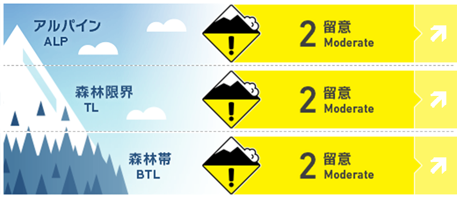
Niseko Yotei Yoichi Shiribeshi
Alpine Fair Look for any signs of wind-pressed snow indicating slab formation at higher elevations on lee slopes.
Treeline Fair New snow may not have bonded well to the previously sun-affected surface on solar aspects.
Below Treeline Fair
信頼度:○ good □ Fair △ Low
Travel and Terrain Advice
Possible varied snow conditions as new snow total increase and further buries the sun crust formed on Friday. Watch for frozen lumps of snow that will have dislodged from trees and may be near the surface. Poor visibility and the dusting of new snow may have obscured open glide cracks that are a hazard at lower elevations.
Avalanche Problem
ストームスラブ Storm slab


New snow is expected to continue with slabs forming over the weekend, the hazard will rise as the new total increase. Show extra caution on solar aspects where this latest new snow will be falling on a sun crust.
ウインドスラブ Wind slab


With increasing snow totals the gusting northwest winds will transport snow onto lees slopes possibly creating slab at higher elevations or in cross-loaded features.
概要
Avalanche
No new activity has been reported in the previous few days.
Snowpack
We have received upwards of 10cm of new snow overnight and into the start of weekend with further snowfall forecasted in the coming days. Periods of sunshine on Friday and warmer temperatures have created a sun crust on the solar aspects which have now been buried. Gusting north west winds will be transporting this latest new snow onto lee slopes.
Weather
Moderate northwest winds and continued snowfall is forecasted for the weekend. Temperatures will remain cold before rising above freezing at the start of next week.


