Avalanche Bulletin
更新日時: 2023/02/26 05:30
Hakuba
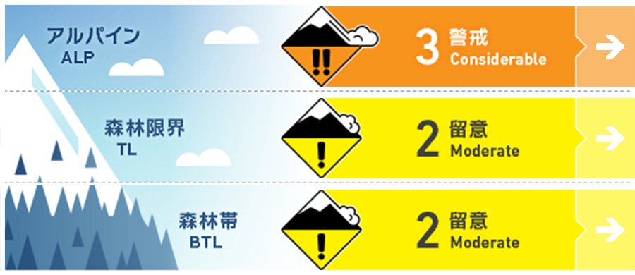
Alpine Fair
Treeline Fair
Below Treeline Good
信頼度:○ good □ Fair △ Low

Travel and Terrain Advice
Be alert for wind-influenced slabs forming on the snowpack surface. Look for wind-induced top-loading and cross-loading of snow just below the ridge line and on the sides of branch ridges. Also, pay attention to the strength of the wind while ski touring. If moderate winds (8-11 m/s) continue to blow that move the snow on the snow surface and shake small trees, it is necessary to assume that dangerous slabs are forming on the downwind side. Also, remember that on the southern slopes, hard Melt-Freeze crusts are hiding under the fresh snow. Have a good day.
Avalanche Problem
ストームスラブ Storm slab


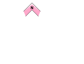
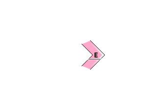
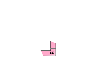
Alert to areas more sedimented by wind.
概要
Avalanche
Yesterday (February 25), a size 1 wind slab avalanche occurred in a ski cut on the northeast to east slopes of the treeline. On slopes unaffected by wind, there was a size 1 loose snow avalanche. Both avalanches were caused by snowfall up to that day.
Snowpack
The new snow from the early morning of the 25th is on top of the settling snow on the northern slopes or Melt-Freeze crusts on the southern slopes. This new snow is more abundant in the northern part of the Hakuba Valley, with amounts of about 30 cm since the beginning of the fall. Because of the relatively light wind conditions until yesterday, there were also some loose snow avalanches on steep slopes that were not affected by the wind. The Nagano District Meteorological Office is forecasting 20 cm of snowfall in the next 24 hours through tomorrow. It is likely that only the higher elevations and northern areas will need to consider it.
Weather
The Japan Meteorological Agency is forecasting northerly winds, cloudy skies, and a high of 3°C (418 m elevation) for northern Nagano Prefecture. At Amedas Hakuba (elevation 703 m), the temperature is -4.8°C (as of 5:00), and 2 cm of snow has fallen in the past 12 hours.


