
Avalanche Bulletin
更新日時: 2023/03/02 05:30
Hakuba
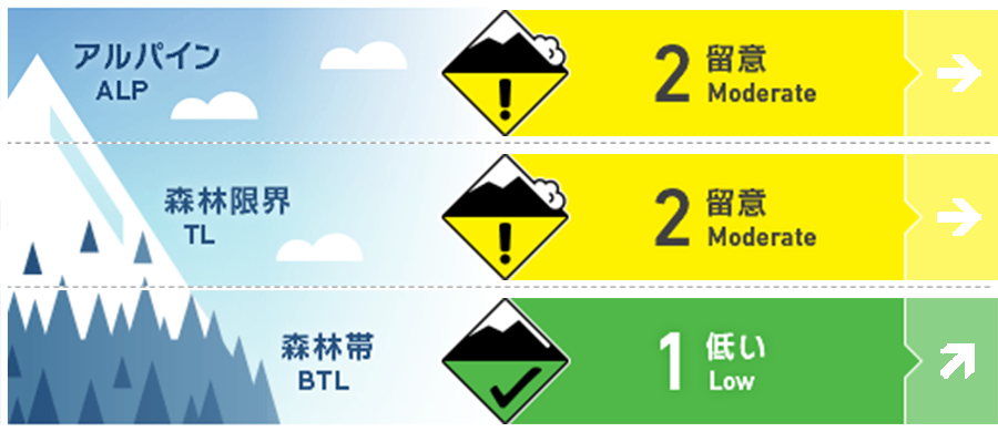
Alpine Fair
Treeline Fair
Below Treeline Fair
信頼度:○ good □ Fair △ Low
Travel and Terrain Advice
Snowfall amounts are still low, but watch out for storm slabs that will be forming. The bonding of new and old snow needs to be checked. Depending on elevation, new snow is on wet or frozen snow surfaces. Also, the weather is forecast to become more windy due to the winter pressure pattern. Please pay attention to changes in wind direction and speed and the resulting snow movement. When visibility is poor, it is difficult to notice hazards above you. It is important to use a terrain map to consider whether there are any large start zones above you.
Avalanche Problem
ストームスラブ Storm slab

















Watch for future snowfall intensity and changes in wind direction. Check for bonding of new and old snow. Below Treeline is only rated for elevations where snowfall is occurring.
概要
Avalanche
Yesterday (March 1), several size 1 wet loose snow avalanches were observed on the south slope of the Below Treeline. Numerous snowballs were also observed.
Snowpack
Yesterday, high temperatures were recorded at 13.7°C at 14:00 at AMeDAS Hakuba. This resulted in the loss of strength of the snowpack surface layer in the Below Treeline, causing loose snow avalanches. Because of the warm temperatures this morning, it is necessary to consider that the danger of glide avalanches continues at very lower elevations. On the other hand, at higher elevations, the snowfall is weak, accompanied by southwesterly winds. At elevations around 1,500 m, there is about 10 cm of new snow. The forecast is for a winter pressure pattern and a change in wind direction from northwest to north. The Nagano District Meteorological Office is forecasting up to 20 cm of snowfall in the next 24 hours until tomorrow morning.
Weather
The Japan Meteorological Agency is forecasting northerly winds, cloudy, with occasional snow or rain, and a high of 9°C (418 m elevation) for northern Nagano Prefecture. At AMeDAS Hakuba (elevation 703 m), the temperature is 1.4°C (as of 5:00 am), with no new snowfall in the past 12 hours.


