
Avalanche Bulletin
更新日時: 2023/03/02 07:00
Niseko Yotei Yoichi Shiribeshi
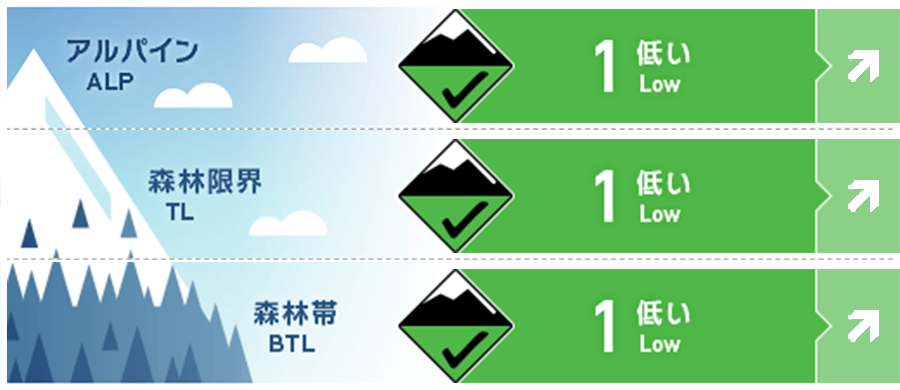
Alpine Good Alpine hazard rating will increase with the arrival of new snow tonight.
Treeline Good Treeline hazard rating will increase with the arrival of new snow tonight.
Below Treeline Good BTL hazard rating will increase with the arrival of new snow tonight.
信頼度:○ good □ Fair △ Low
Travel and Terrain Advice
Travelling conditions are generally poor with a hard melt freeze crust on solar aspects and a temperature crust up to 1000m on Northern slopes. In the alpine the strong SW winds from the previous days has scoured most surfaces that weren`t affected by the solar input. A loose wet cycle occurred during the previous period of warm sunny weather leaving hard avalanche debris on most steep slopes. Tree bombs have also released from many trees leaving hard ice chunks on the slopes below. Conditions will improve as new snow arrives but it will take some time before the damage is reversed.
Avalanche Problem
ウインドスラブ Wind slab


New snow expected tonight and tomorrow will be re-distributed to East slopes creating wind slab.
ストームスラブ Storm slab


Storm slab will begin to form as new snow arrives tonight and through the day tomorrow.
点発生乾雪雪崩 Dry Loose snow


The new snow will fall on hard, re-frozen surfaces causing loose dry avalanches to run easily.
概要
Avalanche
A loose wet avalanche cycle and some cornice failures occurred during the recent warm period.
Snowpack
Recent warm, sunny weather has created a melt freeze crust on all solar slopes and a temperature crust up to 1000m on north facing slopes. Strong SW winds during this time have scoured alpine slopes. The snowpack is well settled and now re-frozen and there are currently no notable avalanche problems however this will change as we start to receive new snow.
Weather
Today we are expecting mostly overcast conditions with the occasional sunny break along with the occasional light flurry higher in the mountains. The freezing level will rise to 150m during the day before dropping back down to sea level in the evening. Winds will be light to moderate from the West throughout this period. Snow is expected to begin this evening continuing through the day tomorrow and overnight Friday night. Avalanche hazard will increase with the arrival of the new snow. Loose dry avalanches will initially be the main problem until accumulations are significant enough for wind slab and storm slab to develop.


