
Avalanche Bulletin
更新日時: 2023/03/04 07:00
Niseko Yotei Yoichi Shiribeshi
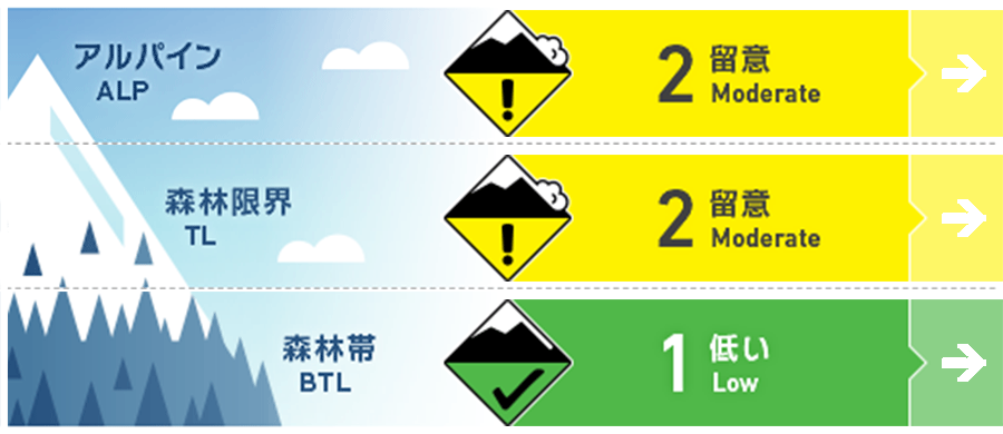
Alpine Good
Treeline Good
Below Treeline Good
信頼度:○ good □ Fair △ Low
Travel and Terrain Advice
Manage the dry loose problem by skiing one at a time and avoiding steep slopes above terrain traps. Look for evidence of wind slab in the alpine and test slopes for reactivity before dropping in. Monitor temperatures and anticipate that the storm slab will become more reactive as temperatures rise. Also keep in mind that just below the new snow there is old avalanche debris and tree bombs from the previous warm period. Ski cautiously particularly at lower elevations to avoid injury. As the temps rise on Sunday and Monday, beware of cornices heating up and releasing onto to the slopes below.
Avalanche Problem
ウインドスラブ Wind slab


Pockets of windslab have developed near ridge crest on leeward slopes.
ストームスラブ Storm slab


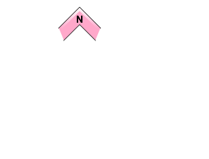


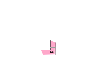



Mild temps will cause the storm snow to settle into a slab and will be reactive until the new snow bonds to the hard surfaces below.
点発生湿雪雪崩 Wet Loose snow


A loose wet avalanche cycle will begin when the sun comes out and temps rise on Sunday and Monday
概要
Avalanche
Loose dry avalanches have been running easily on steep slopes.
Snowpack
Up to 30cms of new snow has fallen in the past 48hours. This new snow overlies a melt freeze crust on most aspects and elevations and hard wind scoured surfaces in the alpine. Northwest winds have created additional loading on leeward slopes causing pockets of windslab to develop in the alpine and treeline zones. The lower snowpack is well consolidated.
Weather
Snow flurries will taper off this morning giving way to overcast skies for the remainder of the day. Temps will remain cool today with a high of -8 expected at 1000m. Weather will improve tomorrow with mostly sunny skies expected Sunday and Monday. This will cause freezing levels to rise to 800m tomorrow and 900m on Monday. Light West Northwest winds are expected throughout this time.

