
Avalanche Bulletin
更新日時: 2023/03/21 07:00
Niseko Yotei Yoichi Shiribeshi
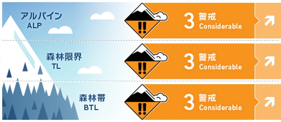
Alpine Good Increasing air temperatures and clear skies will heat the snow surface.
Treeline Good Increasing air temperatures and clear skies will heat the snow surface.
Below Treeline Good Increasing air temperatures and clear skies will heat the snow surface.
信頼度:○ good □ Fair △ Low
Travel and Terrain Advice
With a rapidly warming snow surface, it will be important to judge when to move off sun-heated slopes. Wet avalanches will follow natural terrain features meaning small slides can bury a person deep in terrain traps such as creeks or hollows, always be mindful of what is below you. At lower elevations, rivers and streams are opening up again and all snow bridges should be tested. We have moved into a full soring cycle across the region. The Avalanche bulletin for this area ends today. Thank you for using our service.
Avalanche Problem
点発生湿雪雪崩 Wet Loose snow





With clear skies, warm temperatures, and little wind the snow surface will heat rapidly during daylight hours in the coming days. Roller balling on steep sunny slopes will indicate that the snow surface is losing strength and you should move out of this terrain. A possibility of rain exists for later in the week which would increase this hazard.
全層雪崩 Glide slab


The timing of glide slab avalanches is extremely hard to predict creating a lot of uncertainty around them. Avoiding spending any time underneath one of these features during the heat of the day or if we receive any rainfall is key as when they relase the consequencess are high.
概要
Avalanche
Now new activity has been reported.
Snowpack
Spring-like conditions exist across the region. Surface freezing has been occurring at night with the snowpack heating during the day. In general, the snowpack total has been diminishing as freezing levels rise during the day.
Weather
We currently sit under a high-pressure system centered to our east. The result of this is clear calm conditions with sunny skies and little wind. The freezing level will rise to above 2000m before lowering later in the week.

