
Avalanche Bulletin
更新日時: 2024/01/12 05:30
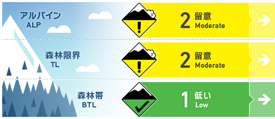
Hakuba
Alpine Fair
Treeline Fair
Below Treeline Good
信頼度:○ good □ Fair △ Low
Travel and Terrain Advice
Although the avalanche danger level for the region as a whole is decreasing, this is a day to be very cautious of the new wind slabs that have formed by this morning. For those who enjoyed backcountry skiing yesterday, consider today "another day" and choose your terrain carefully with a renewed mindset. In particular, pay attention to the slabs that have formed on the east to northeast facing slopes. If triggered by a slab formed near the entrance of a gully, the avalanche will engulf the snow deposited in the terrain and grow larger. Conditions at the entrance of gully terrain often differ from left to right. Please use your best judgment.
Avalanche Problem
ウインドスラブ Wind slab


Alert to new wind slab that had formed by this morning.
ストームスラブ Storm slab









概要
Avalanche
Yesterday (January 11), many size 1 loose snow avalanches were observed. In addition, several naturally occurring slab avalanches of size 1.5-2 were observed on downwind slopes at elevations between 2,000 and 2,700 meters. Size 1 glide avalanches were also observed at very low elevations.
Snowpack
At higher elevations, very strong southwest winds (>20 m/s) blew from midnight to this morning. As a result, the weakly cohesive snow that had been generating loose snow avalanches until yesterday was carried downwind to form new wind slabs. Underneath this dense slab is snow of relatively low density, resulting in an unstable snowpack structure known as an "upside-down structure". Consider this a day when larger avalanches are possible than yesterday.
Weather
A front extending from a low-pressure system in the Sea of Japan is expected to pass over northern Japan, gradually bringing a winter pressure pattern. The Japan Meteorological Agency is forecasting southerly and northerly winds, cloudy, with a daytime high of 7 °C (418 m elevation) for northern Nagano Prefecture. At Amedas Hakuba (elevation 703 m), the temperature is -8.7 °C (as of 5:00), and there has been no new snowfall in the past 24 hours.


