
Avalanche Bulletin
更新日時: 2024/01/15 04:00
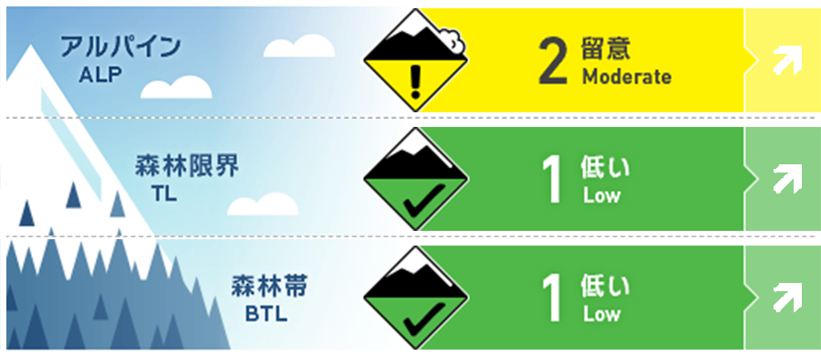
Kagura Tanigawa Hotaka
Alpine Low Watch for increased snowfall and wind effects in the future.
Treeline Fair Watch for increased snowfall and wind effects in the future.
Below Treeline Fair Watch for increased snowfall and wind effects in the future in open areas with few trees.
信頼度:○ good □ Fair △ Low
Travel and Terrain Advice
Beware of bonding storm slabs that exist in alpine areas where there are no trees or other structures to anchor the snowpack, or on open, extremely steep slopes with few trees. There are exposed "terrain traps" such as deep gullies, cliffs, rocks, and standing timber that can increase damage even if the size of the avalanche that occurs is small. At lower elevations, exposed bushes make running difficult. Be careful not to fall into gully. New snowfall has begun. Please be aware of the increased hazard level due to future snowfall.
Avalanche Problem
ストームスラブ Storm slab


Watch for increased snowfall and wind effects in the future.
概要
Avalanche
Yesterday (14th), shooting cracks and a loose snow avalanche size 1 dry avalanche were observed on an extremely steep slope.
Snowpack
At higher elevations, there is about 100 cm of snowfall from the recent stormy weather in many places on top of the snowpack that has been settling, so the settling has progressed and bonding is not so bad. On south-facing slopes, crusts are forming, and bonding of the boundary surface with the snowfall from today's stormy weather should also be noted.
Weather
As of 3:00 pm, about 1 cm of snow has fallen in the past 12 hours in the area around AMeDAS Fujiwara, and it is still falling. The Japan Meteorological Agency is forecasting cloudy skies and snow in the morning and evening at the foot of the mountains in northern Gunma Prefecture as a cold front passes over eastern Japan and creates a winter pressure pattern.