
Avalanche Bulletin
更新日時: 2024/02/11 06:00
Myoko
Alpine Low
Treeline Low
Below Treeline Fair
信頼度:○ good □ Fair △ Low
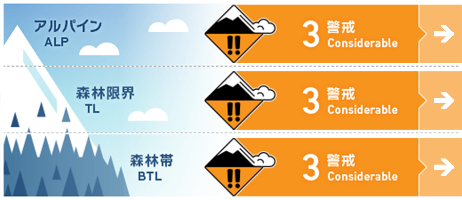
Travel and Terrain Advice
This is a change from yesterday's understandable and safe conditions, and the snowpack in the mountains has become difficult to find. In the bigger picture, be aware of the bonding conditions of new and old snow since yesterday afternoon. Be especially wary of areas where the surface snow has slab characteristics due to the wind. It is important to choose slopes with gentle slopes, no large steep slopes above you, and no "terrain traps" below you. The weather is forecast to improve in the afternoon, but please exercise caution.
Avalanche Problem
ストームスラブ Storm slab








At higher elevations, the new snow that has been affected by the current winds is on relatively low-density new snow, so please check the bonding carefully.
概要
Avalanche
Yesterday (10th), size 1 wet loose snow avalanches and glide avalanches were observed at lower elevations.
Snowpack
Weak winter snowfall began yesterday afternoon. The snowfall was heaviest on the west side of the Myoko Mountains, with about 30 cm in the upper Below Treeline. Please pay attention to the bonding of the new snow with the old snow, which has been affected by the wind. Surface hoar of up to 10 mm has been observed on Mt. Kurohime, which is outside the avalanche bulletin area. Please keep in mind the possibility that surface hoar has formed in the southern part of the Myoko Mountains and that it may be buried under the new snow.
Weather
Today, the area is expected to be affected by cold air and a trough of atmospheric pressure. The Japan Meteorological Agency is forecasting northwest winds, then southerly winds, snow or rain, cloudy before noon, and a daytime high of 7 °C (13 m elevation) for the Joetsu region of Niigata Prefecture. At Sasagamine, Myoko (elevation 1,310 m), the temperature is -6 °C (as of 4:45 a.m.) and 14 cm of snow has fallen in the past 12 hours.

