
Avalanche Bulletin
更新日時: 2024/02/24 07:00
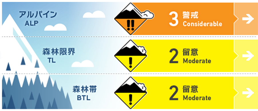
Niseko Yotei Yoichi Shiribeshi
Alpine Fair
Treeline Good
Below Treeline Good
信頼度:○ good □ Fair △ Low
Travel and Terrain Advice
Deep snow travel advisory especially in the northern part of the zone where knee deep trail breaking was reported. There still remains a crust that is felt on steeper terrain and can be hard to control speed. New glide cracks are appearing almost daily now and new terrain should be met with caution for them.
Avalanche Problem
ウインドスラブ Wind slab


Windslab development in the alpine from recent new snow and winds on slopes lee to the wind.
ストームスラブ Storm slab





With significant snowfall in the northern part of the forecast zone like Otaru and Sapporo there is enough snow to create storm slab.
点発生乾雪雪崩 Dry Loose snow


Sheltered slopes below tree line has light density snow( 40 plus cm in Northern zone) on top of a hard and icy crust and will be concern for loose dry especially on steeper slopes, short and long.
概要
Avalanche
No avalanches reported from the recent new snow fall, however loose dry snow becoming more reactive to ski cuts on steep/sheltered slopes yesterday and storm slab observed in northern part of forecast zone and windslab development observed at tree line and above on slopes lee to the wind across the zone.
Snowpack
The lower snow pack is still mostly settled and well bonded, but in the upper snowpack there remains a crust and 40plus cm of new snow on top of the crust that is not well bonded in many places. The northern part of the forecast zone received the most snow with 60cm reported on top of the crust.
Weather
Continued north west flow bringing light winds from the Northwest. Light precipitation today that will taper off tonight. Temps to remain cold and below freezing in most areas with slight warming around Niseko tomorrow near freezing. Winds forecasted to shift from south tomorrow with generally clearer sky and then back into northwest flow of precipitation on Monday.

