Avalanche Bulletin
更新日時: 2024/02/26 06:00
Kagura Tanigawa Hotaka
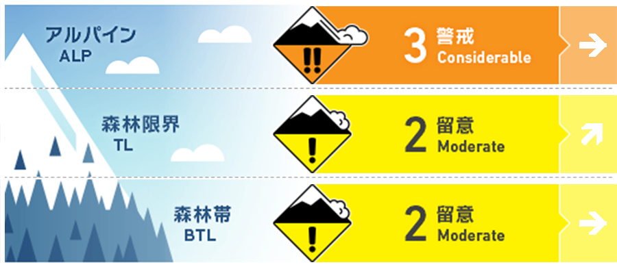
Alpine Low Watch for increased snowfall during the day and wind effects
Treeline Fair Watch for increased snowfall during the day and wind effects
Below Treeline Fair Watch for increased snowfall during the day and wind effects
信頼度:○ good □ Fair △ Low

Travel and Terrain Advice
The winds that have strengthened since midnight are expected to move the snow and form wind slabs on the steep slopes just below the ridge and the branch ridges. Since the bonding of freshly formed wind slabs is weak, please be careful not to trigger them. Due to the low snowpack, "terrain traps" such as deep streams, cliffs, rocks, and standing timber are exposed, which can increase damage even if the size of the avalanche that occurs is small. Care should also be taken to avoid falling into gully. Please be aware of changes in snowfall and wind effects during the day.
Avalanche Problem
ウインドスラブ Wind slab


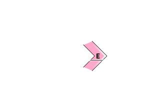
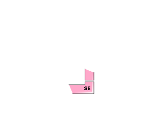
Be careful of steep slopes on the ridge and just below the branch ridge.
概要
Avalanche
No report of observation yesterday (25th) because there were not many visitors.
Snowpack
New snowfall yesterday was about 15 cm at around 1300 m elevation. This snowfall is expected to be moved by strong northwesterly winds that have intensified since midnight, forming wind slabs. Crusts formed by rainfall are buried in the lower 20-30 cm from the surface, but bonding at the boundary is good. No significant vulnerability in the middle to lower part of the snowpack has been reported. The effect of yesterday's rainfall is expected below about 700 m elevation.
Weather
As of 5:00, the temperature at AMeDAS Fujiwara was -0.2°C. New snowfall in the past 24 hours was 4 cm. The Japan Meteorological Agency (JMA) is forecasting clear skies in the foothills of northern Gunma Prefecture with cloudy skies before noon and snow showers in some areas, as a low pressure system moves east-northeast over eastern Japan, creating a low pressure pattern in the west.

