Avalanche Bulletin
更新日時: 2024/03/19 05:30
Hakuba
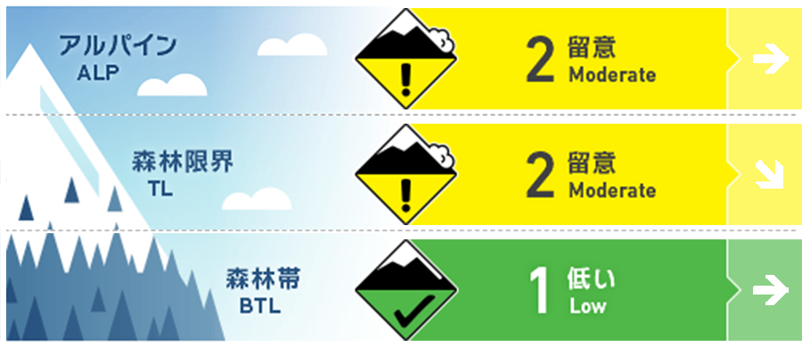
Alpine Low
Treeline Low
Below Treeline Fair
信頼度:○ good □ Fair △ Low

Travel and Terrain Advice
Note any unstable wind slabs that remain on specific terrain. Also consider whether there are any "terrain traps" below that slope. In some areas, very hard snow surfaces that have formed previously are exposed and should be watched for slips and falls. At lower elevations, we are in the melting season this year, with very little snowpack. Please plan your tours by setting routes with a large safety margin.
Avalanche Problem
ウインドスラブ Wind slab


Watch out for slabs formed on convex or isolated terrain, etc.
持続型スラブ Persistent slab


The hazards of persistent slabs remain highly uncertain.
概要
Avalanche
Yesterday (18th), the weather was poor and no avalanche was observed.
Snowpack
Yesterday (18th), the winds were so strong that the gondolas at the ski resort were shut down. On the main ridge, winds continued to blow from the northwest with average wind speeds exceeding 20 m/s. Currently, the wind has weakened slightly and is now blowing from the north. This has resulted in heavy snow movement at higher elevations where snowfall occurred yesterday, forming wind slabs on the leeward side.
Weather
Today, high pressure is expected to prevail, but the area will be affected by a pressure trough and a low pressure system moving southeastward over the Sea of Japan. The Japan Meteorological Agency is forecasting southerly winds, cloudy skies, snow or rain in places, and daytime high temperatures of 10 °C for northern Nagano Prefecture. At 703 m elevation, the temperature is -4.2 °C (as of 5:00 a.m.), and no new snow has fallen in the past 12 hours.


