
Avalanche Bulletin
更新日時: 2024/03/28 07:00
Niseko Yotei Yoichi Shiribeshi
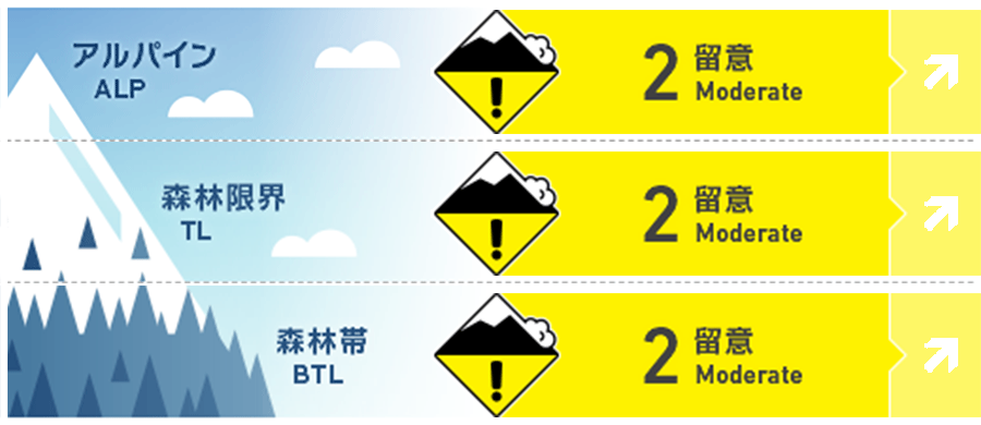
Alpine Good Alpine hazard will increase to considerable during tomorrow`s rain event
Treeline Good Treeline hazard will increase to considerable during tomorrow`s rain event
Below Treeline Good Alpine hazard will increase to considerable during tomorrow`s rain event
信頼度:○ good □ Fair △ Low
Travel and Terrain Advice
Enjoy the remaining hours of nice weather and spring corn conditions today before conditions take a turn for the worse tomorrow. The lack of a good overnight freeze tonight combined with tomorrow`s heavy rain will have a significant impact on the snowpack. During the rain event, cornices are likely to fail, glide cracks may open or release, wet slab avalanches will become possible and wet loose avalanches likely.
Avalanche Problem
点発生湿雪雪崩 Wet Loose snow










Rain will fall at all elevation bands tomorrow increasing the likelihood of wet loose avalanches.
面発生湿雪雪崩 Wet slab


Tomorrow`s heavy rain could be sufficient for enough water to percolate through the snowpack re-activating the Feb. 20th rain crust or other persistent layers within the lower pack.
全層雪崩 Glide slab


Glide slab avalanches remain unlikely and difficult to predict however recent warm weather combined with the upcoming rain event increase the possibility of a full depth glide avalanche
概要
Avalanche
No new avalanches have been reported
Snowpack
North aspects at high elevations are mostly wind scoured while solar aspects and lower elevations are experiencing a daily melt freeze cycle. Pockets of windslab may still exist at higher elevations on sheltered slopes. The lower pack is well settled.
Weather
Clear skies this morning (Thursday) will give way to overcast conditions later in the day as a Southerly flow takes hold over Hokkaido. Winds will be light this morning before increasing to moderate from the South later in the day. A high of +7C is expected in the valley today with temps remaining elevated overnight. The overnight low is expected to be +5C. Tomorrow will bring periods of rain heaviest in the morning as freezing levels climb to 1700m before dropping back down Friday night. Winds tomorrow will be strong to gale force from the South


