
Avalanche Bulletin
更新日時: 2025/01/01 07:00
Niseko Yotei Yoichi Shiribeshi
Alpine Good More N winds and precipitation hit Yoichi area with considerable avalanche danger in the Alpine Today
Treeline Good More N winds and precipitation hit Yoichi area with Moderate avalanche danger in the tree line Today
Below Treeline Low Moderate Danger could exist in cross loaded pockets below tree line Yoichi area
信頼度:○ good □ Fair △ Low

Travel and Terrain Advice
Highly variable surface conditions currently exist. With careful planning good powder riding can be found while limiting the exposure to unacceptable risk and danger. Lower angled sheltered slopes tree line and below less than 35 degrees can be enjoyed with normal precautions taken.
Avalanche Problem
ウインドスラブ Wind slab






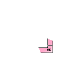



With the recent north flow and wind the Yoichi area has received Stronger ridge top winds and heavy amounts of snow in the last 24 hours. Shiribetsu Yotei have been more sheltered from the new snow and the wind slab problem is moderate in the Alpine
概要
Avalanche
Small Size one pockets 5-10cm deep were ski cut near the summit of Shiribetsu of wind slab . No larger avalanches have been reported
Snowpack
Highly variable surface snow conditions with surface melt crusts, moist snow, where the sun shined yesterday @ lower elevations. New wind slabs in the alpine and tree line, wind scoured crusts windward N and north west facing. Great powder skiing areas sheltered from the winds and sun also exist. Lower snow pack has continued to bond with no persistent weak layers reported.
Weather
Strong North West winds and higher snow amounts favored Yoichi area. As the winds begin to shift to the Northwest snow new snow should begin to fall in the Niseko, Yotei, Shiribetsu areas with only light to moderate ridge top winds. Forecasted New snow totals today should be higher in the southern 1/2 of the forecast area. While the northern expected to received stronger NW wind gusts and less new snow.

