
Avalanche Bulletin
更新日時: 2025/01/30 06:00
Myoko
Alpine Fair
Treeline Fair Lack of information on bonding conditions between new and old snow
Below Treeline Good Danger will increase with the strengthening of wind and snow in the future.
信頼度:○ good □ Fair △ Low

Travel and Terrain Advice
Below treeline hazards are Moderate, but snowpack intensity varies from place to place, making terrain selection an important day. There is a hard Melt-Freeze crust under the new snow, which serves as a good bed surface. Even a very small avalanche can cause a slipping down. Conservative terrain selection is important to avoid steep slopes or convex terrain shapes. Weather conditions are forecast to worsen. Plan your activities with this in mind.
Avalanche Problem
ストームスラブ Storm slab


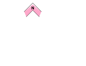









Westerly winds will alert you to areas where the new snow has strong slab characteristics.
概要
Avalanche
Yesterday (29th), a size 1 storm slab avalanche was observed at the ski cut. This is the northeast slope of the below treeline.
Snowpack
Snowfall, which began yesterday morning (29th), has been coming down in increasing intensity, bringing 20-50 cm of new snow by this morning. Snowfall amounts are higher in the western to northwestern areas of the mountain range. The bonding between Melt-Freeze crusts and fresh snow forming below treeline has been reported to vary in intensity from location to location. At higher elevations, information is lacking and uncertainty remains high.
Weather
The Japan Meteorological Agency is forecasting westerly winds, strong, snowy conditions, and a daytime high of 4 °C (13 m elevation) for the Joetsu region of Niigata Prefecture. At Sasagamine, Myoko (elevation 1,310 m), the temperature was -7 °C (as of 3:45 pm), with 19 cm of snow having fallen in the past 12 hours and 49 cm in the past 24 hours. The Niigata District Meteorological Office is forecasting 70 cm of snowfall along the mountains of the Joetsu region at 5:47 a.m. on the 30th for the 24-hour period from the 30th to the 31st.

